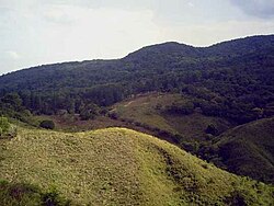
Herrera Province
|
Herrera Province Provincia de Herrera |
||
|---|---|---|
| Province | ||
 |
||
|
||
 Location of Herrera Province in Panama |
||
| Country | Panama | |
| Founded | 1915 | |
| Capital | Chitré | |
| Area | ||
| • Total | 2,340.7 km2 (903.7 sq mi) | |
| Population (2010 census) | ||
| • Total | 111 647 | |
| Time zone | Eastern Time (UTC-5) | |
| ISO 3166 code | PA-6 | |
Coordinates: 7°50′N 80°40′W / 7.833°N 80.667°W
Herrera (Spanish pronunciation: [eˈreɾa]) is a province in Panama. Named after General Tomás Herrera, the province was founded on January 18, 1915 from a division of the Los Santos province. The capital city of Herrera is Chitré, which is located near the province's coastline. Herrera is bordered on the north by the provinces Veraguas and Coclé, on the south by Los Santos, on the east by Golfo de Parita and Los Santos, and on the west by Veraguas.
After gaining independence from Spain in 1821, the isthmus of Panama was divided into two provinces, Panamá and Veraguas. The province Panamá consisted of the districts of Natá, Portobelo, Panama and Darién. At the time, the location now occupied by the city of Chitré was inhabited by a small population of indigenous persons, near La Villa de Los Santos and was governed from Natá. It later came under the control of the Los Santos government. The province of Herrera was created in 1854 and eliminated in 1860. 55 years later, in 1915 the province was created again by the president of Panama Dr. Belisario Porras.
...
Wikipedia

