Henschtal
| Henschtal | ||
|---|---|---|
|
||
| Coordinates: 49°27′59″N 7°24′36″E / 49.46639°N 7.41000°ECoordinates: 49°27′59″N 7°24′36″E / 49.46639°N 7.41000°E | ||
| Country | Germany | |
| State | Rhineland-Palatinate | |
| District | Kusel | |
| Municipal assoc. | Oberes Glantal | |
| Government | ||
| • Mayor | Walter Harth | |
| Area | ||
| • Total | 3.46 km2 (1.34 sq mi) | |
| Elevation | 240 m (790 ft) | |
| Population (2015-12-31) | ||
| • Total | 320 | |
| • Density | 92/km2 (240/sq mi) | |
| Time zone | CET/CEST (UTC+1/+2) | |
| Postal codes | 66909 | |
| Dialling codes | 06383 | |
| Vehicle registration | KUS | |
| Website | henschtal.de | |
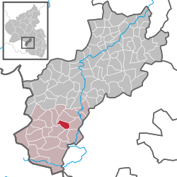
Henschtal is an Ortsgemeinde – a municipality belonging to a Verbandsgemeinde, a kind of collective municipality – in the Kusel district in Rhineland-Palatinate, Germany. It belongs to the Verbandsgemeinde of Oberes Glantal.
Henschtal lies on both sides of its namesake brook, the Henschbach, formed by two smaller streams called the Steinbach and the Hodenbach, which flows right through Henschtal and thence down to the Glan, meeting it upstream from Rehweiler. The Ortsteil of Haschbach lies on the right bank, while the Ortsteil of Trahweiler, whose centre is roughly 500 m upstream, lies on the left bank. The municipal area measures 345 ha, of which 61 ha is wooded.
Haschbach lies on the Henschbach’s right bank, somewhat downstream from Trahweiler and on the other side. The elevation at the bottom of the valley is roughly 240 m above sea level. Towards the south, the slope of the Klopfberg climbs steeply to 380 m above sea level. Some of the land on the slope is wooded. Haschbach does not lie right on the Glan. The tag “am Glan” merely serves to distinguish the Henschtal Ortsteil from the self-administering Ortsgemeinde of Haschbach am Remigiusberg, which lies in the same district.
Trahweiler stretches along a road running parallel to the Henschbach and along a side valley of the Henschbach. The valley floor here lies at an elevation of slightly more than 240 m above sea level, and some of the houses on higher ground stand at about 250 m above sea level. Towards the north, the land climbs steeply, reaching an elevation of 478 m above sea level. The land towards the municipal limit with Wahnwegen is wooded. West of Trahweiler, into Steinbach am Glan’s municipal area, the Hodenbach empties into the Hengsbach. The Hodenbach valley, which along the brook’s northern reaches touches Trahweiler’s (former) municipal area, is held to be a popular recreational area.
...
Wikipedia


