Henderson International School
| Henderson, Nevada | |
|---|---|
| City | |
| City of Henderson | |

Clockwise from top: Water Street Historic District of Downtown Henderson, aerial view of Lake Las Vegas, Foothills near Henderson, Henderson City Hall
|
|
| Motto: A Place to Call Home | |
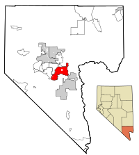
 Location of Henderson in Clark County, Nevada |
|
 U.S. Census map |
|
| Location in the United States | |
| Coordinates: 36°2′N 114°59′W / 36.033°N 114.983°W | |
| Country | |
| State |
|
| County |
|
| Founded | 1941 |
| Incorporated | April 16, 1953 |
| Named for | Charles Henderson |
| Government | |
| • Type | Council-manager |
| • Mayor | Andy Hafen (D) |
| • Manager | Bob Murnane |
| Area | |
| • Total | 107.7 sq mi (279.0 km2) |
| • Land | 107.7 sq mi (279.0 km2) |
| • Water | 0.0 sq mi (0.0 km2) |
| Elevation | 1,867 ft (538 m) |
| Population (2010) | |
| • Total | 257,729 |
| • Estimate (2015) | 285,667 (US: 71st) |
| • Density | 2,514/sq mi (970.6/km2) |
| Time zone | PST (UTC-8) |
| • Summer (DST) | PDT (UTC-7) |
| ZIP codes | 89002, 89009, 89011, 89012, 89014-89016, 89044, 89052, 89053, 89074, 89077 |
| Area code(s) | 702 & 725 |
| FIPS code | 32-31900 |
| GNIS feature ID | 0856267 |
| Website | www |
Henderson, officially the City of Henderson, is a city in Clark County, Nevada, United States, about 16 miles southeast of Las Vegas. It is the second-largest city in Nevada, after Las Vegas, with an estimated population of 285,667 in 2015. The city is part of the Las Vegas metropolitan area, which spans the entire Las Vegas Valley. Henderson occupies the southeastern end of the valley, at an elevation of approximately 1,330 feet (410 m).
In 2011, Forbes magazine ranked Henderson as America's second-safest city. It has also been named as "One of the Best Cities to Live in America" by Bloomberg Businessweek. In 2014, Henderson was again ranked as one of the Top 10 "Safest Cities in the United States" by the FBI Uniform Crime Report.
The township of Henderson first emerged in the 1940s during World War II with the building of the Basic Magnesium Plant. Henderson quickly became a main supplier of magnesium in the United States, which was called the "miracle metal" of World War II. The plant supplied the US War Department with magnesium for incendiary munition casings and airplane engines, frames, and other parts. A quarter of all US wartime magnesium came from the Henderson Plant to strengthen aluminum, using 25% of Hoover Dam's power to separate the metal from its ore by electrolysis. Mayor Jim Gibson's grandfather, Fred D. Gibson, was one of the original engineers sent to Great Britain to learn the secret of creating the "miracle metal" which would eventually help the United States and its allies win the war. The British liaison officer sent to Henderson, Major Charles Ball, had a street named after him. There was some concern that "Ball St," would sound improper, so the street was named "Major Avenue".
Although "born in America's defense", Henderson's future after World War II was uncertain. In 1947, magnesium production was no longer necessary for defense, and the majority of the 14,000 BMI employees moved away. Enrollment in the school system was reduced by two thirds, and well over half the townsite houses, built to house plant workers, became vacant. In 1947, the United States War Asset Administration had offered Henderson for sale as war surplus property.
...
Wikipedia

