Hell's Kitchen (Manhattan)
| Hell's Kitchen | |
|---|---|
| Neighborhood of Manhattan | |

Looking south on Ninth Avenue from 49th Street
|
|
| Nickname(s): HK, Clinton | |
| Location of Hell's Kitchen | |
| Coordinates: 40°45′45″N 73°59′36″W / 40.76250°N 73.99333°WCoordinates: 40°45′45″N 73°59′36″W / 40.76250°N 73.99333°W | |
| Country |
|
| State |
|
| City |
|
| Borough | Manhattan |
| Area | |
| • Total | 0.841 sq mi (2.18 km2) |
| Population (2010) | |
| • Total | 45,884 |
| • Density | 55,000/sq mi (21,000/km2) |
| Ethnicity | |
| • White | 56.4% |
| • Asian or Pacific Islander | 15.0% |
| • Hispanic | 19.3% |
| • Black | 6.3% |
| • Other | 3.0% |
| ZIP code | 10018, 10019, 10036 |
| Area code(s) | 212, 917, 646 |
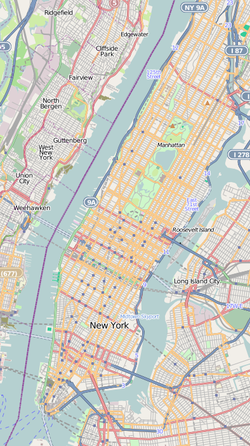
Hell's Kitchen, also known as Clinton, is a neighborhood on the West Side of Midtown Manhattan in New York City. It is traditionally considered to be bordered by 34th Street to the south, 59th Street to the north, Eighth Avenue to the east, and the Hudson River to the west. The area provides transport, medical, and warehouse-infrastructure support to Midtown's business district.
Once a bastion of poor and working class Irish Americans, Hell's Kitchen's location in Midtown has changed its personality since the 1970s. Though Hell's Kitchen's gritty reputation had long held real-estate prices below those of most other areas of Manhattan, by 1969, the City Planning Commission's Plan for New York City reported that development pressures related to its Midtown location were driving people of modest means from the area. Since the early 1990s, the area has been gentrifying, and rents have risen rapidly. Located close to both Broadway theaters and the Actors Studio training school, Hell's Kitchen has long been a home to learning and practicing actors, and, in recent years, to young Wall Street financiers.
The name "Hell's Kitchen" generally refers to the area from 34th to 59th Streets. Starting west of Eighth Avenue and north of 43rd Street, city zoning regulations generally limit buildings to six stories. As a result, most of the buildings are older, and are often apartments. For the most part, the neighborhood encompasses the ZIP codes 10019 and 10036. The post office for 10019 is called Radio City Station, the original name for Rockefeller Center on Sixth Avenue.
...
Wikipedia


