Heber-Overgaard, Arizona
| Heber-Overgaard, Arizona | |
|---|---|
| CDP | |
 |
|
 Location in Navajo County and the state of Arizona |
|
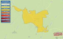
 U.S. Census (2010) |
|
| Location in the United States | |
| Coordinates: 34°24′47″N 110°33′52″W / 34.41306°N 110.56444°WCoordinates: 34°24′47″N 110°33′52″W / 34.41306°N 110.56444°W | |
| Country |
|
| State |
|
| County | Navajo |
| Settled | 1883 |
| Government | |
| • Type | Unincorporated |
| • Body | Navajo County Board of Supervisors |
| Area | |
| • Total | 6.86 sq mi (17.77 km2) |
| • Land | 6.86 sq mi (17.77 km2) |
| • Water | 0.0 sq mi (0.0 km2) |
| Elevation | 6,627 ft (2,020 m) |
| Population (2010 census) | |
| • Total | 2,822 |
| • Density | 411.2/sq mi (158.83/km2) |
| Demonym(s) | Heberite |
| Time zone | MST (UTC−7) |
| • Summer (DST) | no DST/PDT (UTC−7) |
| ZIP code | 85928, 85933 |
| Area code(s) | 928 |
| FIPS code | 04-32310 |
| GNIS ID(s) | 2408368, 29842, 32586 |
| Website | www |
Heber-Overgaard is a census-designated place (CDP) in Navajo County, Arizona, United States. Situated atop the Mogollon Rim, the community lies at an elevation of 6,627 feet (2,020 m). The town is located approximately 144 miles (231.74 km) north of Phoenix, at the junction of SR 260 and SR 277, between Payson and Show Low, Arizona. The population was 2,822 at the 2010 census.
Heber was settled in 1883, by members of The Church of Jesus Christ of Latter-day Saints (LDS Church), and the town is named after either Heber J. Grant or Heber C. Kimball, both prominent members of the LDS church. Overgaard, adjoining Heber, was settled in the mid-late 1930s and was named after the owner of the first sawmill, "Niels Kristian Overgaard".
Tourism, retirement and timbering are the foundations of Heber-Overgaard's economy.
In March 1873, Mormon pioneers from Utah were sent to the Little Colorado River area under the direction of Horton D. Height. In 1876, a large group of these settlers established four settlements on the Little Colorado River, which they named Brigham City, Sunset, Obed and Allen's Camp (Joseph City). In Allen's Camp, a dam had been built on the Little Colorado River in April, but high waters in July washed it out. By August, many settlers had returned to Utah. Eight married couples and six single men were all that remained in Allen's Camp. By 1882, the Obed settlement had collapsed and both Brigham City and Sunset were near collapse due to several years of drought. At this time, John Bushman, of Allen's Camp, was sent by Lot Smith, then president of the Little Colorado Stake, to scout the forests to the south in anticipation of relocation. Dry farming in the forested mountains was thought to be easier due to higher rain fall, lush grasses, and plentiful timber.
...
Wikipedia

