Hebbronville, Texas
| Hebbronville, Texas | |
|---|---|
| CDP | |

Water tower in Hebbronville
|
|
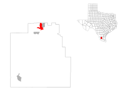
 Location of Hebbronville, Texas |
|
 |
|
| Coordinates: 27°18′41″N 98°40′52″W / 27.31139°N 98.68111°WCoordinates: 27°18′41″N 98°40′52″W / 27.31139°N 98.68111°W | |
| Country | United States |
| State | Texas |
| County | Jim Hogg |
| Area | |
| • Total | 5.9 sq mi (15.3 km2) |
| • Land | 5.9 sq mi (15.3 km2) |
| • Water | 0.0 sq mi (0.0 km2) |
| Elevation | 548 ft (167 m) |
| Population (2010) | |
| • Total | 4,558 |
| • Density | 763.4/sq mi (294.8/km2) |
| Time zone | Central (CST) (UTC-6) |
| • Summer (DST) | CDT (UTC-5) |
| ZIP code | 78361 |
| Area code(s) | 361 |
| FIPS code | 48-33008 |
| GNIS feature ID | 1337545 |
Hebbronville (/ˈhɛbrənvɪl/ HEB-rən-vill) is a census-designated place (CDP) in and the county seat of Jim Hogg County, Texas, United States. The population was 4,558 at the 2010 census. In 1918, Helen Sewel Harbison became the first woman in Texas to cast a ballot, two years before the implementation of the Nineteenth Amendment to the United States Constitution.
The Colegio Altamirano, founded by settlers of Spanish ancestry who wanted their children to learn Spanish culture, was an institution in Hebbronville from 1897 until its closing in 1958.
The community calls itself the "Vaquero Capitol of Texas and the USA."
Hebbronville is located at 27°18′41″N 98°40′52″W / 27.31139°N 98.68111°W (27.311259, -98.680998).
According to the United States Census Bureau, the CDP has a total area of 5.9 square miles (15 km2), all of it land.
...
Wikipedia
