Hayward Executive Airport
|
Hayward Executive Airport (former Hayward Army Air Field) |
|||||||||||||||
|---|---|---|---|---|---|---|---|---|---|---|---|---|---|---|---|

USGS 2006 orthophoto
|
|||||||||||||||
| Summary | |||||||||||||||
| Airport type | Public | ||||||||||||||
| Owner | City of Hayward | ||||||||||||||
| Serves | Hayward, California | ||||||||||||||
| Elevation AMSL | 52 ft / 16 m | ||||||||||||||
| Coordinates | 37°39′32″N 122°07′18″W / 37.65889°N 122.12167°WCoordinates: 37°39′32″N 122°07′18″W / 37.65889°N 122.12167°W | ||||||||||||||
| Website | www.hayward-ca.gov/airport | ||||||||||||||
| Maps | |||||||||||||||
 FAA airport diagram |
|||||||||||||||
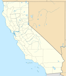
| Location of airport in California | |||||||||||||||
| Runways | |||||||||||||||
|
|||||||||||||||
| Helipads | |||||||||||||||
|
|||||||||||||||
| Statistics (2010) | |||||||||||||||
|
|||||||||||||||
|
Source: Federal Aviation Administration
|
|||||||||||||||
| Aircraft operations | 86,069 |
|---|---|
| Based aircraft | 368 |
Hayward Executive Airport (IATA: HWD, ICAO: KHWD, FAA LID: HWD) is a city owned public airport located in Hayward, California, United States. The National Plan of Integrated Airport Systems for 2011–2015 categorized it as a reliever airport. The towered airport near the east shore of San Francisco Bay was formerly the Hayward Air Terminal.
The airport was built in 1942 during World War II as an auxiliary field to Chico Army Air Field and was originally Hayward Army Air Field. The primary aircraft were Lockheed P-38 Lightnings. This post may have also been named "Russell City Army Air Field" for the unincorporated area outside of the Hayward city limits where it was located. The airfield was assigned to the United States Army Air Forces Fourth Air Force.
After the war the airport was declared surplus. In April 1947 the War Assets Administration quitclaimed the airfield, comprising some 690 acres (279 ha) and related buildings and equipment, to the City of Hayward. The airfield was then renamed Hayward Municipal Airport.
...
Wikipedia

