Haydarpaşa
| Haydarpaşa | |
|---|---|
| Neighborhood | |
| Coordinates: 41°00′N 29°01′E / 41.000°N 29.017°ECoordinates: 41°00′N 29°01′E / 41.000°N 29.017°E | |
| Country |
|
| Region | Marmara |
| Province | Istanbul |
| District | Kadıköy |
| Time zone | EET (UTC+2) |
| • Summer (DST) | EEST (UTC+3) |
| Postal code | 34716 |
| Area code | 0-216 |
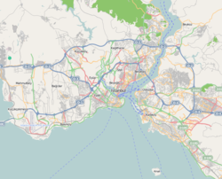
Haydarpaşa is a neighborhood within the Kadıköy district on the Asian part of Istanbul, Turkey. The place, on the coast of Sea of Marmara, borders to Harem in the northwest and Kadıköy in the southeast. It is a historical area with almost solely public buildings.
Internationally known structures around the area are the Haydarpaşa Terminal, Port of Haydarpaşa and the Selimiye Barracks in adjacent Harem.
Following public structures, built in the 19th century or early 20th century during the Ottoman era, are found in Haydarpaşa:
...
Wikipedia

