Hawaii County
| Hawaii County, Hawaii | ||
|---|---|---|
|
||
 Location in the U.S. state of Hawaii |
||
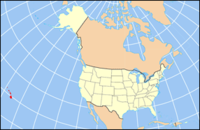
 Hawaii's location in the U.S. |
||
| Founded | 1905 | |
| Seat | Hilo | |
| Largest city | Hilo | |
| Area | ||
| • Total | 5,086.70 sq mi (13,174 km2) | |
| • Land | 4,028.02 sq mi (10,433 km2) | |
| • Water | 1,058.69 sq mi (2,742 km2), ?% | |
| Population (est.) | ||
| • (2015) | 196,428 | |
| • Density | 46/sq mi (17.7/km²) | |
| Congressional district | 2nd | |
| Time zone | Hawaii-Aleutian: UTC-10 | |
| Website | co |
|
Hawaiʻi County is a county located in the U.S. state of Hawaii in the Hawaiian Islands. It is with the Island of Hawaiʻi, often called the "Big Island" to distinguish it from the state as a whole. As of the 2010 Census the population was 185,079. The county seat is Hilo. There are no incorporated cities in Hawaiʻi County (see Hawaii Counties). The Hilo Micropolitan Statistical Area includes all of Hawaiʻi County. Hawaiʻi County has a mayor-council form of government. Hawaii County is the largest county in the state, in terms of geography.
The current Mayor of Hawaii County is Harry Kim, who took office in 2016. Legislative authority is vested in a nine-member Hawaii County Council.
Hawaii County is one of seven counties in the United States to share the same name as the state they are located in (the other six counties are Arkansas County, Idaho County, Iowa County, New York County, Oklahoma County, and Utah County).
Hawaiʻi County has a total area of 5,086.70 square miles (13,174.5 km2); 4,028.02 square miles (10,432.5 km2) is land and 1,058.69 square miles (2,742.0 km2) is water (mostly all off the ocean shoreline but counted in the total area by the U.S. Census Bureau). The county's land area comprises 62.7 percent of the state's land area. It is the highest percentage by any county in the United States. (Delaware's Sussex County comes in second at 48.0 percent, while Rhode Island's Providence County is third at 39.55 percent.)
...
Wikipedia

