Hartville, Ohio
| Hartville, Ohio | |
|---|---|
| Village | |

Hartville Pie Factory
|
|
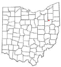
 Location of Hartville, Ohio |
|
 Location of Hartville in Stark County |
|
| Coordinates: 40°57′44″N 81°20′23″W / 40.96222°N 81.33972°WCoordinates: 40°57′44″N 81°20′23″W / 40.96222°N 81.33972°W | |
| Country | United States |
| State | Ohio |
| County | Stark |
| Township | Lake |
| Area | |
| • Total | 2.58 sq mi (6.68 km2) |
| • Land | 2.58 sq mi (6.68 km2) |
| • Water | 0 sq mi (0 km2) |
| Elevation | 1,168 ft (356 m) |
| Population (2010) | |
| • Total | 2,944 |
| • Estimate (2012) | 2,943 |
| • Density | 1,141.1/sq mi (440.6/km2) |
| Time zone | Eastern (EST) (UTC-5) |
| • Summer (DST) | EDT (UTC-4) |
| ZIP code | 44632 |
| Area code(s) | 330 |
| FIPS code | 39-34328 |
| GNIS feature ID | 1064808 |
Hartville is a village in Stark County, Ohio, United States. The population was 2,944 at the 2010 census. It is part of the Canton-Massillon, OH Metropolitan Statistical Area.
Hartville lies halfway between Akron and Canton, at the intersection of two main roads, State Routes 43 and 619.
Hartville is located at 40°57′44″N 81°20′23″W / 40.96222°N 81.33972°W (40.962207, -81.339822).
According to the United States Census Bureau, the village has a total area of 2.58 square miles (6.68 km2), all land.
Hartville was platted in 1851, most likely deriving its name from John Morehart, a first settler.
As of the census of 2010, there were 2,944 people, 1,154 households, and 806 families residing in the village. The population density was 1,141.1 inhabitants per square mile (440.6/km2). There were 1,276 housing units at an average density of 494.6 per square mile (191.0/km2). The racial makeup of the village was 96.1% White, 0.8% African American, 0.1% Native American, 0.7% Asian, 0.5% from other races, and 1.9% from two or more races. Hispanic or Latino of any race were 1.0% of the population.
...
Wikipedia
