Harrisville, Ohio
| Harrisville, Ohio | |
|---|---|
| Village | |

The Fireman and Auxiliary Hall on U.S. Route 250
|
|
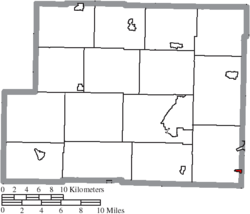
 Location of Harrisville, Ohio |
|
 Location of Harrisville in Harrison County |
|
| Coordinates: 40°10′55″N 80°53′13″W / 40.18194°N 80.88694°WCoordinates: 40°10′55″N 80°53′13″W / 40.18194°N 80.88694°W | |
| Country | United States |
| State | Ohio |
| County | Harrison |
| Area | |
| • Total | 0.15 sq mi (0.39 km2) |
| • Land | 0.15 sq mi (0.39 km2) |
| • Water | 0 sq mi (0 km2) |
| Elevation | 1,250 ft (381 m) |
| Population (2010) | |
| • Total | 235 |
| • Estimate (2012) | 234 |
| • Density | 1,566.7/sq mi (604.9/km2) |
| Time zone | Eastern (EST) (UTC-5) |
| • Summer (DST) | EDT (UTC-4) |
| ZIP code | 43974 |
| Area code(s) | 740 |
| FIPS code | 39-34090 |
| GNIS feature ID | 1048821 |
Harrisville is a village in Harrison County, Ohio, United States. The population was 235 at the 2010 census.
During Morgan's Raid, a Union victory in the Civil War in 1863, Confederate Brig. Gen. John Hunt Morgan traveled through the Moorefield, Harrisville, New Athens, Smithfield, New Alexandria, Wintersville, Two Ridge, Richmond, East Springfield, Bergholz, and Monroeville on his way to defeat at the Battle of Salineville.
Harrisville was platted by John Wells, Thomas Gray, Store Hutchinson, and Robert Dutton on October 19, 1814. The plat was filed on January 9, 1815 with John Wells as proprietor.
Harrisville is located at 40°10′55″N 80°53′13″W / 40.18194°N 80.88694°W (40.181820, -80.886956).
According to the United States Census Bureau, the village has a total area of 0.15 square miles (0.39 km2), all land.
...
Wikipedia
