Harbord Village
| Harbord Village | |
|---|---|
| Neighbourhood | |

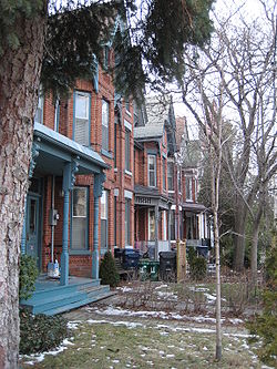
Bay-and-gable houses in Harbord Village
|
|
 |
|
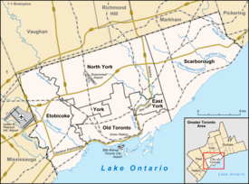
| Location within Toronto | |
| Coordinates: 43°39′40″N 79°24′22″W / 43.661°N 79.406°WCoordinates: 43°39′40″N 79°24′22″W / 43.661°N 79.406°W | |
| Country |
|
| Province |
|
| City |
|
| Government | |
| • MP | Adam Vaughan (Trinity—Spadina) |
| • MPP | Han Dong (Trinity—Spadina) |
| • Councillor | Joe Cressy (Ward 20 Trinity—Spadina) |
Harbord Village is a neighbourhood in Toronto, Ontario, Canada. It lies just to the west of the University of Toronto, with its most commonly accepted borders being Bloor Street on the north, Spadina Avenue on the east, College Street to the south, and Bathurst Street to the west. Areas west of Bathurst, as far as Ossington are also sometimes included, though they are not covered by the residents' association. The area was previously known as Sussex-Ulster, after two of the major east west streets in the area. In 2000 the residents' association decided to rename itself and the area Harbord Village, after the main street running through the middle of the community. The area is also sometimes referred to as the South Annex after the better known “Annex” community to the north. The city of Toronto for administrative purposes places Harbord Village and most of the St. George campus into a region it calls “University.”
The area was built up in the late nineteenth century as a working class and lower middle class community, not as prosperous as the mansions of the Annex to the north, but also not a poor and immigrant-heavy neighbourhood like Kensington Market just to the south. In the 20th century it became an immigrant reception area linked to Spadina Avenue and Kensington Market. The neighbourhood was predominantly Jewish from the 1920s until the 1960s and was home to community institutions such as the Brunswick Avenue Talmud Torah.First Narayever Congregation has been located on Brunswick Avenue since 1940.
In the 1960s and 1970s, the area became heavily populated by students and other people linked to the university, as well as to an influx of Portuguese and Chinese immigrants. Parts of the area were designated under the city′s slum clearance program. In 1968 this began as the block along Robert Street, south of Bloor, was demolished to make way for highrise towers, similar to those of St. James Town. The local residents organized to block this move, founding the Sussex-Ulster Residents' Association. They were successful, smaller towers were built on part of the land and the rest was given to the University of Toronto which uses it as a sports field.
...
Wikipedia

