Harbor, Oregon
| Harbor, Oregon | |
|---|---|
| Census-designated place | |

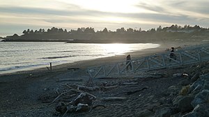
The beach at Harbor
|
|
 Location of Harbor, Oregon |
|
| Coordinates: 42°2′27″N 124°15′13″W / 42.04083°N 124.25361°WCoordinates: 42°2′27″N 124°15′13″W / 42.04083°N 124.25361°W | |
| Country | United States |
| State | Oregon |
| County | Curry |
| Founded | 1894 |
| Area | |
| • Total | 2.31 sq mi (5.98 km2) |
| • Land | 1.92 sq mi (4.97 km2) |
| • Water | 0.39 sq mi (1.01 km2) |
| Elevation | 33 ft (10 m) |
| Population (2010) | |
| • Total | 2,391 |
| • Density | 1,246/sq mi (481.0/km2) |
| Time zone | Pacific (PST) (UTC-8) |
| • Summer (DST) | PDT (UTC-7) |
| ZIP code | 97415 |
| Area code(s) | 458 and 541 |
| FIPS code | 41-32100 |
| GNIS feature ID | 1143296 |
Harbor (Tolowa: chit ) is an unincorporated community in Curry County, Oregon, United States. It is located across the Chetco River from the city of Brookings. For statistical purposes, the United States Census Bureau has defined Harbor as a census-designated place (CDP). The census definition of the area may not precisely correspond to local understanding of the area with the same name. The population of the CDP was 2,391 at the 2010 census.
The original name of the post office in the area was "Chetco", after the Chetco River. It was established in 1863 and moved several times until it closed in 1910. Meanwhile, a new post office named Harbor was established at the mouth of the Chetco River in 1894. The name of the office may have originated from the Chetco Harbor Land and Townsite Company.
Harbor is located in southwestern Curry County along U.S. Route 101, 1 mile (1.6 km) east of the center of Brookings and 5 miles (8 km) north of the California state line. According to the United States Census Bureau, the CDP has a total area of 2.3 square miles (6.0 km2), of which 1.9 square miles (5.0 km2) is land and 0.39 square miles (1.0 km2), or 16.88%, is water.
As of the census of 2000, there were 2,622 people, 1,333 households, and 798 families residing in the CDP. The population density was 1,399.6 people per square mile (541.4/km²). There were 1,691 housing units at an average density of 902.6 per square mile (349.1/km²). The racial makeup of the CDP was 94.20% White, 0.34% African American, 2.17% Native American, 0.19% Asian, 0.08% Pacific Islander, 0.92% from other races, and 2.10% from two or more races. Hispanic or Latino of any race were 3.05% of the population.
...
Wikipedia
