Hampton, New York
| Hampton | |
|---|---|
| Town | |
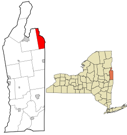
 Location in Washington County and the state of New York. |
|
| Coordinates: 43°33′N 73°18′W / 43.550°N 73.300°WCoordinates: 43°33′N 73°18′W / 43.550°N 73.300°W | |
| Country | United States |
| State | New York |
| County | Washington |
| Area | |
| • Total | 22.6 sq mi (58.6 km2) |
| • Land | 22.6 sq mi (58.4 km2) |
| • Water | 0.1 sq mi (0.2 km2) |
| Elevation | 633 ft (193 m) |
| Population (2010) | |
| • Total | 938 |
| • Density | 38.6/sq mi (14.9/km2) |
| Time zone | Eastern (EST) (UTC-5) |
| • Summer (DST) | EDT (UTC-4) |
| ZIP code(s) | 12837 (primary) 12887 Whitehall |
| Area code(s) | 518 |
| FIPS code | 36-31885 |
| GNIS feature ID | 0979041 |
Hampton is a town in northeastern Washington County, New York, United States. It is part of the Glens Falls Metropolitan Statistical Area. The town population was 938 at the 2010 census increasing 7.2% since the 2000 census. The town of Hampton is located in the northeast corner of Washington County.
The current Town Supervisor is Dave O'Brien. The current Town Board consists of Don Sady, Andrea Sweeney, Tamme Taran, and Dave Jensen. The current Highway Superintendent is Herb Sady. The current Town Clerk is Becky Jones.
This area of New York was part of a jurisdictional dispute between New York and Vermont. The matter was not settled until after 1790.
The town was formed in 1786 and was once called "Hampton Corners" and "Greenfield." It was founded by Brent W Perry, former American Revolutionary War officer. The first town meeting was conducted in his home. Many of the first settlers were from Massachusetts and Connecticut. The land contains parts of early land patents, including Skene's Little Patent and those issued to groups of British officers.
In 1783, the Poultney River at the east town line suddenly changed course and became unnavigable due to a sudden influx of water.
Red slate and other colored slate were mined here.
The William Miller Chapel and Ascension Rock was listed on the National Register of Historic Places in 1975.
According to the United States Census Bureau, the town has a total area of 22.6 square miles (59 km2), of which, 22.6 square miles (59 km2) of it is land and 0.1 square miles (0.26 km2) of it (0.35%) is water.
The eastern part of the town forms a border with Vermont. Part of the boundary is marked by the Poultney River, which flows into Lake Champlain.
...
Wikipedia
