Hamirpur, Himachal Pradesh
|
Hamirpur हमीरपुर |
|
|---|---|
| town | |
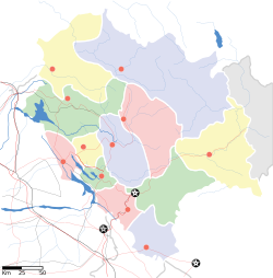
| Location in Himachal Pradesh, India | |
| Coordinates: 31°41′N 76°31′E / 31.68°N 76.52°ECoordinates: 31°41′N 76°31′E / 31.68°N 76.52°E | |
| Country |
|
| State | Himachal Pradesh |
| District | Hamirpur |
| Government | |
| • Zonal Headquarters | Mandi |
| Area | |
| • Total | 5.2 km2 (2.0 sq mi) |
| Elevation | 738 m (2,421 ft) |
| Population (2011) | |
| • Total | 17,604 |
| • Rank | 12 in HP |
| • Density | 3,385/km2 (8,770/sq mi) |
| Languages | |
| • Official | Hindi |
| Time zone | IST (UTC+5:30) |
| Telephone code | 1972 |
Hamirpur (Hindi|हमीरपुर) is a town and the district headquarters of Hamirpur district in the Himalayan state of Himachal Pradesh, India. Hamirpur is located in a relatively colder region in western Himachal Pradesh with a lower altitude as compared to the other districts of the state.
Shri Siddh Baba Balak Nath Temple, Deotsidh, is the biggest holy shrine in Barsar tehsil of the district. It is situated on the Deotsidh Dhar Range in Shivalik Hills. It stretches across 44 kilometers from Hamirpur, 185 kilometers from Chandigarh, 93 kilometers from Nangal Dam (Railway Station), 64 kilometers from Una, 16 kilometers from Barsar and about 5 kilometers from Shah Talai.
The exact geographical co-ordinates of Hamirpur is 31°41′N 76°31′E / 31.68°N 76.52°E, and the average elevation is 738 m (2,421 ft).
Hamirpur is mainly a hilly terrain.
These statistics are from the 2011 census of India; "growth" is the change since 2001 census data as a percentage of the 2001 data:
This segment of Himachal Pradesh is also known as politically hot segment in state politics. BJP had a greater influence on this particular region. In 1967, Kanshiram Thakur elected as first non congress MLA from this segment, Ramesh Verma of congress remain MLA from 1972 to 1977. Later in 1977, an advocate by profession Thakur Jagdev Chand (Nephew of Kanshiram Thakur) became the MLA of Hamirpur by defeating Ramesh Verma.
...
Wikipedia


