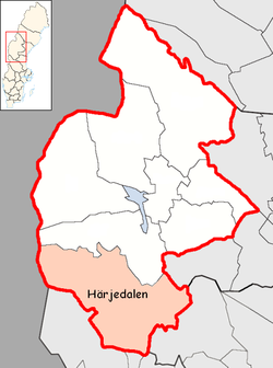
Härjedalen Municipality
|
Härjedalen Municipality Härjedalens kommun |
||
|---|---|---|
| Municipality | ||
|
||
 |
||
| Country | Sweden | |
| County | Jämtland County | |
| Seat | Sveg | |
| Area | ||
| • Total | 11,859.62 km2 (4,579.02 sq mi) | |
| • Land | 11,286.1 km2 (4,357.6 sq mi) | |
| • Water | 573.52 km2 (221.44 sq mi) | |
| Area as of January 1, 2014. | ||
| Population (December 31, 2016) | ||
| • Total | 10,200 | |
| • Density | 0.86/km2 (2.2/sq mi) | |
| Time zone | CET (UTC+1) | |
| • Summer (DST) | CEST (UTC+2) | |
| ISO 3166 code | SE | |
| Province | Härjedalen, Hälsingland and Dalarna | |
| Municipal code | 2361 | |
| Website | www.herjedalen.se | |
Härjedalen Municipality (Swedish: Härjedalens kommun) is a municipality in Jämtland County in northern Sweden. Its seat is located in Sveg.
The municipality roughly, but not exactly, corresponds with the traditional province Härjedalen.
The municipality was created in 1974 and is one of two in Sweden with the name of a province (Gotland Municipality is the other). It consists of nine original local government entities (as of 1863).
With a total area of 11,935 km², it is Sweden's fifth largest. However, it is largely wilderness, and the municipality is sparsely inhabited. For comparison, the municipality covers as much territory as Uppsala County and combined, but those two counties have over 2,000,000 inhabitants.
The population has been in decline in the last decades. The birth/death rate is negative, and so is net migration.
Of the total population, 4% are immigrants from other countries. The national average is 12%.
There are eight localities (or urban areas) in Härjedalen Municipality:
The municipal seat in bold
Coordinates: 62°02′N 14°21′E / 62.033°N 14.350°E
...
Wikipedia

