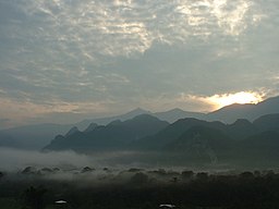
Gunung Mulu National Park
| Gunung Mulu National Park | |
| Protected Area | |
|
Mount Mulu viewed from a distance
|
|
| Country | Malaysia |
|---|---|
| State | Sarawak |
| Highest point | |
| - location | Mount Mulu |
| Area | 528.64 km2 (204 sq mi) |
| Geology | Extensive caves including the world's largest cave chamber |
| Plant | Nepenthes pitcher plants, strangler figs |
| Animal | Gibbons, orangutans, rhinoceros hornbills, Sumatran rhinoceroses, sun bears |
| Founded | 1974 |
| Management | Sarawak Forestry |
| UNESCO World Heritage Site | |
| Name | Gunung Mulu National Park |
| Year | 2000 (#24) |
| Number | 1013 |
| Region | Asia-Pacific |
| Criteria | vii, viii, ix, x |
Coordinates: 4°07′55″N 114°55′08″E / 4.132°N 114.919°E
The Gunung Mulu National Park is a national park in Miri Division, Sarawak, Malaysia, is a UNESCO World Heritage Site that encompasses caves and karst formations in a mountainous equatorial rainforest setting. The park is famous for its caves and the expeditions that have been mounted to explore them and their surrounding rainforest, most notably the Royal Geographical Society Expedition of 1977–1978, which saw over 100 scientists in the field for 15 months. This initiated a series of over 20 expeditions now drawn together as the Mulu Caves Project.
The national park is named after Mount Mulu, the second highest mountain in Sarawak.
Gunung Mulu National Park is famous for its limestone karst formations. Features include enormous caves, vast cave networks, rock pinnacles, cliffs and gorges. Mount Mulu is a sandstone mountain rising to 2,376 m (7,795 ft).
Gunung Mulu National Park has the largest known natural chamber or room – Sarawak Chamber, found in Gua Nasib Bagus. It is 700 m (2,300 ft)) long, 396 m (1,299 ft) wide and at least 70 m (230 ft) high. It has been said that the chamber is so big that it could accommodate about 40 Boeing 747s, without overlapping their wings. The nearby Deer Cave is one of the largest single cave passages in the world.
...
Wikipedia

