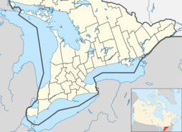
Gull River (Balsam Lake)
| Gull River | |
| River | |
| Country | Canada |
|---|---|
| Province | Ontario |
| County | Haliburton |
| Municipalities | Algonquin Highlands, Dysart et al, Kawartha Lakes |
| Part of | Great Lakes Basin |
| Tributaries | |
| - right | Boshkung River, Kennisis River, Redstone River |
| City | Minden, Coboconk, Norland |
| Source | Longboot Lake |
| - location | Southern Algonquin Provincial Park in Dysart et al, Haliburton County |
| - elevation | 457 m (1,499 ft) |
| - coordinates | 45°13′16″N 78°16′00″W / 45.22111°N 78.26667°W |
| Mouth | Balsam Lake |
| - location | Coboconk, Kawartha Lakes |
| - elevation | 256.3 m (841 ft) |
| - coordinates | 44°38′28″N 78°48′19″W / 44.64111°N 78.80528°WCoordinates: 44°38′28″N 78°48′19″W / 44.64111°N 78.80528°W |
| Discharge | |
| - average | 20 m3/s (706 cu ft/s) |
| - max | 27 m3/s (953 cu ft/s) |
| - min | 12 m3/s (424 cu ft/s) |
|
The Gull River drainage basin
|
|
The Gull River is a river in Algonquin Highlands and Dysart et al, Haliburton County and the single-tier municipality of Kawartha Lakes in south-central Ontario, Canada. It is in the Trent River and Lake Ontario drainage basins, and flows from southern Algonquin Provincial Park to Balsam Lake on the Trent–Severn Waterway.
While there are no sources as to the naming of the Gull river, one of the possible origins is a translation of the name of the village of Coboconk. The name is translated from the Indian (Likely Ojibwa) term, Quash-qua-be-conk, meaning "where the gulls nest." The town of Minden, about 30 kilometres (19 mi) north, was named Gull River prior to April 1, 1859.
The Gull River begins at Longboot Lake in the geographic township of Bruton in Dysart et al, Haliburton County. This is in the southern arm of Algonquin Provincial Park, and just south of the York River in the Ottawa River drainage basin. The river leaves the lake at the southeast and loops east, south, west and north west to Percy Lake.
The Gull River drainage basin is an important reservoir for the Trent–Severn Waterway. The lakes of the system were flooded during the 1800s by man-made cofferdams in order to preserve the flow of the river throughout the year. While the original purpose of this was to aid lumberjacks — who were cutting pine, spruce and hemlock in the area — in sending logs downstream to Trenton after the initial spring flooding had subsided, it would serve a dual purpose when the lock between Balsam Lake and Cameron Lake was completed in 1873, connecting Trenton with Coboconk. Balsam lake was raised 5 metres to provide enough depth for steamboats passing through the lock.
...
Wikipedia


