Guánica State Forest
| Guánica State Forest | |
|---|---|

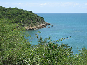
Partial view of the coastal area of the forest
|
|
| Location | Puerto Rico |
| Nearest city | Guánica |
| Coordinates | 17°57′56″N 66°52′45″W / 17.96556°N 66.87917°WCoordinates: 17°57′56″N 66°52′45″W / 17.96556°N 66.87917°W |
| Area | 9,878 acres (39.97 km2) |
| Established | 1919 |
| Governing body | Department of Natural Resources of Puerto Rico |
The Guánica State Forest (Spanish: Bosque Estatal de Guánica) is a subtropical dry forest located in southwest Puerto Rico. The area was designated as a forest reserve in 1919 and a United Nations Biosphere Reserve in 1981. It is considered the best preserved, subtropical forest and the best example of dry forest in the Caribbean.
Located in the dry orographic rain shadow of the Cordillera Central, Puerto Rico's driest area, temperatures in the forest are, on average, around 80 °F (27 °C) in shaded areas and 100 °F (38 °C) in exposed areas. The average temperature is 25.3 °C (77.5 °F) and the average annual rainfall is 791 millimetres (31.1 in).
Approximately half of Puerto Rico's birds and nine of sixteen the endemic bird species occur in the Guánica State Forest.
The vegetation in the forest is divided into three main groups: upland deciduous forest (which occupies 23.5 square kilometres or 9.1 square miles), semi-evergreen forest (7.2 square kilometres or 2.8 square miles), and scrub forest (5.8 square kilometres or 2.2 square miles). Similar to other insular dry forests species diversity is low; between 30 and 50 tree species are found per ha. More than 700 plant species, of which 48 are endangered and 16 are endemic to the forest, occur within the forest.
...
Wikipedia

