Grosse Pointe Shores
| Grosse Pointe Shores | ||
|---|---|---|
| City | ||
| Village of Grosse Pointe Shores, A Michigan City | ||

|
||
|
||
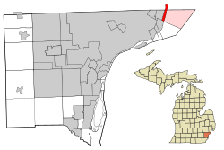
 Location in Wayne County and the state of Michigan |
||
| Coordinates: 42°26′19″N 82°52′15″W / 42.43861°N 82.87083°WCoordinates: 42°26′19″N 82°52′15″W / 42.43861°N 82.87083°W | ||
| Country | United States | |
| State | Michigan | |
| Counties | Wayne, Macomb | |
| Government | ||
| • Mayor | Thaddeus J. Kedzierski | |
| Area | ||
| • Total | 19.23 sq mi (49.81 km2) | |
| • Land | 1.15 sq mi (2.98 km2) | |
| • Water | 18.08 sq mi (46.83 km2) | |
| Elevation | 581 ft (177 m) | |
| Population (2010) | ||
| • Total | 3,008 | |
| • Estimate (2016) | 2,918 | |
| • Density | 160/sq mi (60/km2) | |
| Time zone | EST (UTC-5) | |
| • Summer (DST) | EDT (UTC-4) | |
| ZIP codes | 48230, 48236 | |
| Area code(s) | 313 | |
| FIPS code | 26-82453 | |
| GNIS feature ID | 2398212 | |
| Website | gpshoresmi.gov | |
Grosse Pointe Shores is a city in the U.S. state of Michigan. The city, which is entirely residential, is the location of the Grosse Pointe Yacht Club on Lake Saint Clair. The city's population was 3,008 at the 2010 census. It has the 70th highest income for a municipality with over 1,000 citizens in the country and the second highest income in the state of Michigan.
On February 24, 2009, the residents of Grosse Pointe Shores voted to incorporate as a city with the name "Village of Grosse Pointe Shores, A Michigan City," which took place on April 1. Prior to incorporation as a city, the village encompassed the entire area of two small townships. Most of the former village was within Grosse Pointe Township in Wayne County. A tiny portion of the village was within Lake Township in Macomb County.
Grosse Pointe Shores was incorporated as a village in 1911. The village incorporated as a city in 2009. In 2011, the city government stated that it is considering trying to move all of the city into Macomb County, since Macomb County has lower taxes than Wayne County.
According to the United States Census Bureau, the city has a total area of 19.23 square miles (49.81 km2), of which 1.15 square miles (2.98 km2) is land and 18.08 square miles (46.83 km2) is water, (part of Lake St. Clair).
As of the census of 2010, there were 3,008 people, 1,201 households, and 911 families residing in the city. The population density was 2,615.7 inhabitants per square mile (1,009.9/km2). There were 1,350 housing units at an average density of 1,173.9 per square mile (453.2/km2). The racial makeup of the city was 92.8% White, 1.9% African American, 0.3% Native American, 3.8% Asian, 0.2% from other races, and 1.0% from two or more races. Hispanic or Latino of any race were 1.9% of the population.
...
Wikipedia

