Große Aue
| Große Aue | |
|---|---|

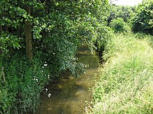
The 'young' Große Aue in its upper course forms the boundary of the towns Lübbecke and Preußisch Oldendorf here for about a kilometre
|
|
| Location |
North Rhine-Westphalia and Lower Saxony, |
| Reference no. | DE: 476 |
| Basin features | |
| Main source | northeast of Bieren 130 m above sea level (NN) 52°14′50″N 8°32′40″E / 52.24722°N 8.54444°ECoordinates: 52°14′50″N 8°32′40″E / 52.24722°N 8.54444°E |
| River mouth | near Binnen into die Weser 22 m above sea level (NN) 52°37′22″N 9°9′49″E / 52.62278°N 9.16361°E |
| Progression | Weser → North Sea |
| River system | Weser |
| Basin size | 1517 km² (458 km² in NRW) |
| Landmarks |
|
| Tributaries |
|
| Waterbodies | Lakes: Großer Auesee |
| Physical characteristics | |
| Length | 84.5 km |
The Große Aue (in its upper reaches known as the Aue and then also the Neuer Mühlenbach or Mühlbach) is an 84.5 kilometres (52.5 mi) long, southwestern, left tributary of the River Weser in northern North Rhine-Westphalia and central Lower Saxony in Germany.
The Große Aue rises at a height of 130 m above sea level (NN) as the Aue on the southern side of the Wiehen Hills in the village of Dono in the parish of Rödinghausen in North Rhine-Westphalia. After one and a half kilometres it turns north and from its confluence with the Nordbach, which joins it from the west at Schwenningdorf, is known as the Große Aue. It crosses a water gap in the Wiehen Hills, losing 40 metres of height and powering two mills, so that in the section through the Wiehen crest it has been named the Neuer Mühlbach ("New Mill Stream") after the Neue Mühle ("New Mill") at Schwenningdorf. Further downstream near Fiegenburg it collects a tributary from the west which drains the entire Egge valley (Eggetal), and is then known as the Mühlbach ("Mill Stream"), powering the mill at Gut Grollage, east of the Egge in front of the main crest of the Wiehen Hills. At Bad Holzhausen it loses the name Mühlenbach. Here the Große Aue reaches the North German Plain. At 10.6 kilometres it passes under the Mittelland Canal. On the western edge of Espelkamp (65 kilometres)in the river meadows (riveraue) on the far side of the dyke, two small lakes have been laid out: the Großer Auesee and the See am Kleihügel. The river continues north, passing Rahden to the west, to Preußisch Ströhen (northernmost village in Rahden borough), here it picks up the waters of the Großer Dieckfluss,before crossing the border into Lower Saxony. Here the valley is part of the 'bog belt' (Moorgürtel). Between kilometres 62.8 and 58.8 the Großer Aue flows in two parallel channels, of which one has been straightened, the other is the first part of a renaturalised route. Through Wagenfeld-Ströhen the Großer Aue runs to Barenburg. It flows eastwards through the southern part of the Sulingen Gap and is then forced south by the geest hills of the Steyerberg Forest. Beyond Steyerberg it turns towards the northeast and reaches after a few kilometres the Weser Depression, on whose western edge it flows through Liebenau, in order five kilometres later near Binnen, half way to Nienburg, discharging into the River Weser. Its total length is about 85 kilometres (53 mi).
...
Wikipedia
