Greer, Arizona
| Greer, Arizona | |
|---|---|
| Census-designated place | |

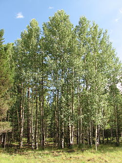
Aspens in Greer
|
|
| Coordinates: 34°00′36″N 109°27′31″W / 34.01000°N 109.45861°WCoordinates: 34°00′36″N 109°27′31″W / 34.01000°N 109.45861°W | |
| Country | United States |
| State | Arizona |
| County | Apache |
| Area | |
| • Total | 0.5 sq mi (1.4 km2) |
| • Land | 0.5 sq mi (1.4 km2) |
| • Water | 0.0 sq mi (0.0 km2) |
| Elevation | 8,356 ft (2,547 m) |
| Population (2010) | |
| • Total | 41 |
| • Density | 78/sq mi (30.0/km2) |
| Time zone | MST (UTC-7) |
| • Summer (DST) | MDT (UTC-6) |
| FIPS code | 04-29850 |
| GNIS feature ID | 0029593 |
Greer is an unincorporated community and census-designated place in Apache County, Arizona, United States. It lies at an elevation of approximately 8,300 feet (2,500 m) in the White Mountains of Arizona, and is surrounded by the Apache-Sitgreaves National Forest. As of the 2010 census it had a population of 41. Greer was founded around 1879 by Mormon settlers from Utah. The Greer post office has the ZIP code of 85927.
Greer is a town located near the towns of Springerville and Eagar in northeast Arizona, near the New Mexico border. Its position in the valley of the Little Colorado River near various lakes means that temperatures are significantly milder than surrounding areas. Sunrise Park Resort, a skiing resort, is located about half an hour's drive west.
While Greer is a four-hour drive from Phoenix and over a five-hour drive from Tucson, it remains one of the most popular summer vacation destinations in Arizona, as it is consistently 20-30 degrees cooler than the deserts.
Greer was founded by Mormon Willard Lee and his family in 1879. A small community named Lee Valley gradually developed. The Post Office requested a shorter name, so Greer (after Americus Vespucius Greer, a town planner who had recently moved to the area) was settled on.
...
Wikipedia

