Greenwood County, South Carolina
| Greenwood County, South Carolina | ||
|---|---|---|
|
||
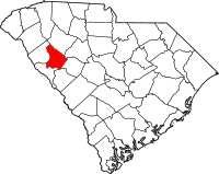
 Location in the U.S. state of South Carolina |
||
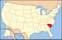
 South Carolina's location in the U.S. |
||
| Founded | 1897 | |
| Seat | Greenwood | |
| Largest city | Greenwood | |
| Area | ||
| • Total | 463 sq mi (1,199 km2) | |
| • Land | 455 sq mi (1,178 km2) | |
| • Water | 8.2 sq mi (21 km2), 1.8% | |
| Population | ||
| • (2010) | 69,661 | |
| • Density | 153/sq mi (59/km²) | |
| Congressional district | 3rd | |
| Time zone | Eastern: UTC-5/-4 | |
| Website | www |
|
Greenwood County is a county located in the U.S. state of South Carolina. As of the 2010 census, its population was 69,661. Its county seat is Greenwood.
Greenwood County is included in the Greenwood, SC Micropolitan Statistical Area, which is also included in the Greenville-Spartanburg-Anderson, SC Combined Statistical Area.
Greenwood County was formed in 1897 from portions of Abbeville and Edgefield counties, which had originally been part of the old Ninety-Six District. It was named for its county seat, Greenwood. This had been named around 1824 after a plantation owned by John McGehee, an early resident. The area was developed largely for cotton plantations and was dependent on slave labor. It has continued to be agricultural in the 21st century.
Greenwood County was the site of the November 1898 Phoenix Election riot.
According to the U.S. Census Bureau, the county has a total area of 463 square miles (1,200 km2), of which 455 square miles (1,180 km2) is land and 8.2 square miles (21 km2) (1.8%) is water. Greenwood County is in the Savannah River basin and the Saluda River basin.
...
Wikipedia

