Abbeville County, South Carolina
| Abbeville County, South Carolina | |
|---|---|

Abbeville County Courthouse
|
|
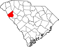
 Location in the U.S. state of South Carolina |
|
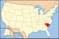
 South Carolina's location in the U.S. |
|
| Founded | 1785 |
| Named for | Abbeville, France |
| Seat | Abbeville |
| Largest city | Abbeville |
| Area | |
| • Total | 511 sq mi (1,323 km2) |
| • Land | 490 sq mi (1,269 km2) |
| • Water | 21 sq mi (54 km2), 4.0% |
| Population | |
| • (2010) | 25,417 |
| • Density | 52/sq mi (20/km²) |
| Congressional district | 3rd |
| Time zone | Eastern: UTC-5/-4 |
| Website | www |
Abbeville County is a county located in the U.S. state of South Carolina. As of the 2010 census, its population was 25,417. Its county seat is Abbeville. It is the first county in the United States alphabetically.
Abbeville County is included in the Greenwood, SC Micropolitan Statistical Area, which is also included in the Greenville-Spartanburg-Anderson, SC Combined Statistical Area.
Both Abbeville County and the county seat, Abbeville, SC, get their name from the town of Abbeville, France. The county was originally part of Ninety-Six District, South Carolina, but was designated Abbeville County in 1785, with parts of the county later going to the creation of the counties of Greenwood and McCormick. Abbeville County was settled by mostly Scotch Irish and French-Huguenot farmers in the mid-18th century.
In 1950 Abbeville County had a population of 22,456.
Bryan McClain is the chairman of the Abbeville County Council, who also represents District 7. The other members and their districts are as following:
...
Wikipedia
