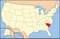
Greenville County, SC
| Greenville County, South Carolina | |
|---|---|

Former Greenville County Courthouse (now a bookstore and office space)
|
|
 Location in the U.S. state of South Carolina |
|
 South Carolina's location in the U.S. |
|
| Founded | March 22, 1786 |
| Government • County Administrator |
Joseph M. Kernell |
| Seat | Greenville |
| Largest city | Greenville |
| Area | |
| • Total | 795 sq mi (2,059 km2) |
| • Land | 785 sq mi (2,033 km2) |
| • Water | 9.7 sq mi (25 km2), 1.2% |
| Population (est.) | |
| • (2016) | 498,766 |
| • Density | 615/sq mi (237/km²) |
| Congressional districts | 3rd, 4th |
| Time zone | Eastern: UTC-5/-4 |
| Website | www |
Greenville County is a county located in the state of South Carolina, in the United States. As of the 2010 census, the population was 451,225, making it the most populous county in the state. Its county seat is Greenville. The county is also home to the Greenville County School District, the largest school system in South Carolina. County government is headquartered at Greenville County Square.
Greenville County is included in the Greenville-Anderson-Mauldin, SC Metropolitan Statistical Area.
According to the U.S. Census Bureau, the county has a total area of 795 square miles (2,060 km2), of which 785 square miles (2,030 km2) is land and 9.7 square miles (25 km2) (1.2%) is water.
As of the 2010 United States Census, there were 451,225 people, 176,531 households, and 119,362 families residing in the county. The population density was 574.7 inhabitants per square mile (221.9/km2). There were 195,462 housing units at an average density of 249.0 per square mile (96.1/km2). The racial makeup of the county was 73.8% white, 18.1% black or African American, 2.0% Asian, 0.3% American Indian, 0.1% Pacific islander, 3.9% from other races, and 1.9% from two or more races. Those of Hispanic or Latino origin made up 8.1% of the population. In terms of ancestry, 13.0% were American, 11.6% were German, 10.9% were English, and 10.7% were Irish.
...
Wikipedia
