Greenup, Kentucky
| Greenup, Kentucky | |
|---|---|
| City | |

Greenup County Courthouse
|
|
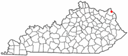
 Location of Greenup, Kentucky |
|
| Coordinates: 38°34′25″N 82°50′1″W / 38.57361°N 82.83361°WCoordinates: 38°34′25″N 82°50′1″W / 38.57361°N 82.83361°W | |
| Country | United States |
| State | Kentucky |
| County | Greenup |
| Established | February 4, 1818 |
| Incorporated | February 29, 1848 |
| Named for | its county |
| Government | |
| • Type | Mayor-Council |
| • Mayor | Lundie Meadows |
| Area | |
| • Total | 1.23 sq mi (3.18 km2) |
| • Land | 0.78 sq mi (2.03 km2) |
| • Water | 0.44 sq mi (1.15 km2) |
| Elevation | 536 ft (160 m) |
| Population (2010) | |
| • Total | 1,188 |
| • Density | 1,513/sq mi (584.3/km2) |
| Time zone | Eastern (EST) (UTC-5) |
| • Summer (DST) | EDT (UTC-4) |
| ZIP code | 41144 |
| Area code(s) | 606 |
| FIPS code | 21-33004 |
| GNIS feature ID | 0493340 |
| Website | www |
Greenup is a home rule-class city located at the confluence of the Little Sandy River with the Ohio River in Greenup County, Kentucky, in the United States. The population was 1,188 at the 2010 census. Greenup is one of three county seats in the Commonwealth of Kentucky to share its name with its county; the other two being Harlan and Henderson.
Greenup is a part of the Huntington-Ashland, WV-KY-OH Metropolitan Statistical Area (MSA). As of the 2010 census, the MSA had a population of 287,702.
Greenup was laid out in 1803 and 1804 by Robert Johnson, a pioneer and legislator who owned the land. Upon the formation of Greenup County (named for the former congressman and future governor Christopher Greenup) out of land separated from Mason County, Johnson's settlement was chosen to be the seat of government and adopted the name "Greenupsburg". Its post office was erected on July 1, 1811. The state assembly formally established the town on February 4, 1818, and incorporated the city thirty years later on February 29, 1848. The name was shortened to "Greenup" on March 13, 1872, partially to avoid confusion with Greensburg.
...
Wikipedia
