Greenfield, Milwaukee County, Wisconsin
| Greenfield, Wisconsin | ||
|---|---|---|
| City | ||
|
||
| Motto: pledged to progress | ||
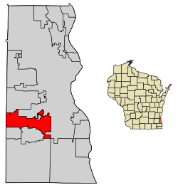
 Location of Greenfield in Milwaukee County, Wisconsin. |
||
| Coordinates: 42°57′47″N 87°59′45″W / 42.96306°N 87.99583°WCoordinates: 42°57′47″N 87°59′45″W / 42.96306°N 87.99583°W | ||
| Country | United States | |
| State | Wisconsin | |
| County | Milwaukee | |
| Area | ||
| • Total | 11.52 sq mi (29.84 km2) | |
| • Land | 11.51 sq mi (29.81 km2) | |
| • Water | 0.01 sq mi (0.03 km2) | |
| Elevation | 794 ft (242 m) | |
| Population (2010) | ||
| • Total | 36,720 | |
| • Estimate (2016) | 36,858 | |
| • Density | 3,190.3/sq mi (1,231.8/km2) | |
| Time zone | Central (CST) (UTC-6) | |
| • Summer (DST) | CDT (UTC-5) | |
| Zip Code(s) | 53129, 53219, 53220, 53221, 53227, 53228 | |
| Area code(s) | 414 | |
| FIPS code | 55-31175 | |
| GNIS feature ID | 1565841 | |
| Website | www |
|
Greenfield is a city in Milwaukee County, Wisconsin, United States. A suburb of Milwaukee, Greenfield is one of many bedroom communities in the Milwaukee metropolitan area. The population was 36,720 at the 2010 census.
On March 8, 1839, the Town of Kinnikennick was created by the territorial legislature, encompassing the western part of the Town of Lake); and on December 20, 1839, the south portion of the Town of Kinnikennick was split off to form the town of Franklin. As of the 1840 census, the population of the Town of Kinnikennick or Kinnikinnick was 404.
On February 19, 1841, the name of the town was changed to Greenfield, taking its name from the name of the Post Office in the Town of Kinnickinnic. Greenfield was the final municipality in Milwaukee County to incorporate, and was the final municipality to leave the Town form of government in 1957. This was done to prevent total annexation by the City of Milwaukee. Before 1957, Milwaukee slowly nibbled away at Greenfield's land.
Greenfield is located at 42°57′47″N 87°59′45″W / 42.96306°N 87.99583°W (42.963034, -87.995943). The Root River flows through the western part of the city.
...
Wikipedia

