Greeley, CO Metropolitan Statistical Area
| Weld County, Colorado | |
|---|---|

Weld County Courthouse
|
|
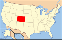
 Location in the U.S. state of Colorado |
|
 Colorado's location in the U.S. |
|
| Founded | November 1, 1861 |
| Seat | Greeley |
| Largest city | Greeley |
| Area | |
| • Total | 4,017 sq mi (10,404 km2) |
| • Land | 3,987 sq mi (10,326 km2) |
| • Water | 30 sq mi (78 km2), 0.7% |
| Population (est.) | |
| • (2015) | 285,174 |
| • Density | 63/sq mi (24/km²) |
| Congressional district | 4th |
| Time zone | Mountain: UTC-7/-6 |
| Website | www |
Weld County is one of the 64 counties of the U.S. state of Colorado. As of the 2010 census, the population was 252,825. The county seat is Greeley.
Weld County comprises the Greeley, CO Metropolitan Statistical Area, which is also included in the Denver-Aurora, CO Combined Statistical Area.
On May 30, 1854, the Kansas-Nebraska Act created the Nebraska Territory and the Kansas Territory, divided by the Parallel 40° North (Baseline Road or County Line Road or Weld County Road 2 in the future Weld County). Present-day Weld County, Colorado, lay in the southwestern portion of the Nebraska Territory, bordering the Kansas Territory.
In July 1858, gold was discovered along the South Platte River in Arapahoe County, Kansas Territory. This discovery precipitated the Pike's Peak Gold Rush. Many residents of the mining region felt disconnected from the remote territorial governments of Kansas and Nebraska, so they voted to form their own Territory of Jefferson on October 24, 1859. The following month, the Jefferson Territorial Legislature organized 12 counties for the new territory, including St. Vrain County. St. Vrain County was named in honor of Ceran de Hault de Lassus de St. Vrain, the French trader who established the first trading post on the upper South Platte River. St. Vrain County encompassed much of what is today Weld County.
...
Wikipedia
