Greatwood, Texas
| Greatwood, Texas | |
|---|---|
| Census-designated place | |
 |
|
| Location within the state of Texas | |
| Coordinates: 29°33′14″N 95°40′31″W / 29.55389°N 95.67528°WCoordinates: 29°33′14″N 95°40′31″W / 29.55389°N 95.67528°W | |
| Country | United States |
| State | Texas |
| County | Fort Bend |
| Area | |
| • Total | 2.75 sq mi (7.11 km2) |
| • Land | 2.69 sq mi (6.97 km2) |
| • Water | 0.05 sq mi (0.14 km2) |
| Elevation | 69 ft (21 m) |
| Population (2010) | |
| • Total | 11,538 |
| • Density | 4,285/sq mi (1,654.4/km2) |
| Time zone | Central (CST) (UTC-6) |
| • Summer (DST) | CDT (UTC-5) |
| FIPS code | 48-30806 |
| GNIS feature ID | 1852709 |
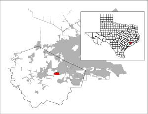
Greatwood is a census-designated place and master-planned community located in the extraterritorial jurisdiction of Sugar Land within Fort Bend County, Texas, United States. The population was 11,538 at the 2010 census, up from 6,640 at the 2000 census. It is in the process of being annexed into the City of Sugar Land with completion scheduled in 2017.
American General started development of Greatwood in 1989. Newland Communities later took control of the rebuilding. By 2008 Greatwood was built-out.
In November 2016 the Sugar Land city council voted in favor of the city annexing Greatwood and New Territory by the end of 2017.
Greatwood is located in eastern Fort Bend County at 29°33′14″N 95°40′31″W / 29.55389°N 95.67528°W (29.553813, -95.675319). It is bounded on the north by Interstate 69/U.S. Route 59, on the west by Crabb River Road, and on the north by the city of Sugar Land. The community is south of the Brazos River. The southern edge of the CDP runs generally along Rabbs Bayou, though parts of the sections known as Greatwood Knoll and Greatwood Crossing lie south of Rabbs Bayou. Four homes along Macek Road are on north side of the bayou across a private bridge and are not part of the master-planned community. North of Rabbs Bayou, a watercourse known as Middle Bayou runs from west to east through Greatwood to the Brazos River. Both Rabbs and Middle Bayous are channelized.
According to the United States Census Bureau, the CDP has a total area of 2.7 square miles (7.1 km2), of which 2.7 square miles (7.0 km2) is land and 0.04 square miles (0.1 km2), or 1.93%, is water.
...
Wikipedia


