Granger, Wyoming
| Granger, Wyoming | |
|---|---|
| Town | |

Granger stage station, built in 1856, on Old U.S. Route 30
|
|
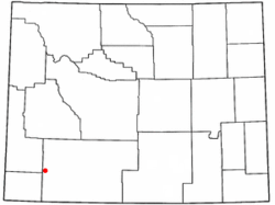
 Location of Granger, Wyoming |
|
| Location in the United States | |
| Coordinates: 41°35′39″N 109°58′0″W / 41.59417°N 109.96667°WCoordinates: 41°35′39″N 109°58′0″W / 41.59417°N 109.96667°W | |
| Country | United States |
| State | Wyoming |
| County | Sweetwater |
| Area | |
| • Total | 2.53 sq mi (6.55 km2) |
| • Land | 2.53 sq mi (6.55 km2) |
| • Water | 0 sq mi (0 km2) |
| Elevation | 6,273 ft (1,912 m) |
| Population (2010) | |
| • Total | 139 |
| • Estimate (2012) | 142 |
| • Density | 54.9/sq mi (21.2/km2) |
| Time zone | Mountain (MST) (UTC-7) |
| • Summer (DST) | MDT (UTC-6) |
| ZIP code | 82934 |
| Area code(s) | 307 |
| FIPS code | 56-32870 |
| GNIS feature ID | 1589030 |
Granger is a town in Sweetwater County, Wyoming, United States. The population was 139 at the 2010 census. It is located near the confluence of the Blacks Fork and the Hams Fork rivers. The geography of the area is flat with semi-arid scrub.
Although the population has always been small, the site is located at the intersection of the Oregon Trail and the Overland Stage Trail and it was chosen for a stage coach station. The station, which was built of stone and adobe in 1856, was in operation when Mark Twain passed through, and still stands today. The Pony Express used this station as a stopover in 1861-62. Later, in 1868, it became a stop on the railroad, which was when it started to be called Granger.
The area of what is present-day Granger had significance to the mountain men who trapped in the early years of the American West. It was chosen as the site of their annual rendezvous in 1834 (the rendezvous was still somewhat spread out, as each supplier set up camp at different location along the river). The American Fur Company, among other suppliers, were present, and American Indians and trappers traded furs for goods. Several weeks were spent recounting events from the previous year and reveling in assorted amusements, while lubricated with liquor. The records show that the event occurred at the junction of the Hams Fork and Blacks Fork rivers.
Granger is located at 41°35′39″N 109°58′0″W / 41.59417°N 109.96667°W (41.594036, -109.966607).
...
Wikipedia

