
Goslar
| Goslar | ||
|---|---|---|
 |
||
|
||

Goslar
|
||
|
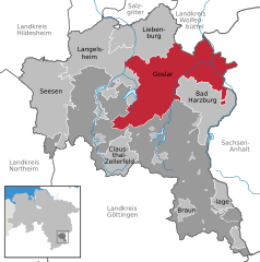
Location of Goslar within Goslar district
  |
||
| Coordinates: 51°54′26″N 10°25′48″E / 51.90722°N 10.43000°ECoordinates: 51°54′26″N 10°25′48″E / 51.90722°N 10.43000°E | ||
| Country | Germany | |
| State | Lower Saxony | |
| District | Goslar | |
| Government | ||
| • Lord Mayor | Dr Oliver Junk (CDU) | |
| Area | ||
| • Total | 163.71 km2 (63.21 sq mi) | |
| Population (2015-12-31) | ||
| • Total | 50,782 | |
| • Density | 310/km2 (800/sq mi) | |
| Time zone | CET/CEST (UTC+1/+2) | |
| Postal codes | 38640, 38642, 38644 | |
| Dialling codes | 05321, 05325 | |
| Vehicle registration | GS | |
| Website | www.goslar.de | |

| Mines of Rammelsberg, Historic Town of Goslar and Upper Harz Water Management System | |
|---|---|
| Name as inscribed on the World Heritage List | |
 |
|
| Location | Germany |
| Type | Cultural |
| Criteria | i, iv |
| Reference | 623 |
| UNESCO region | Europe and North America |
| Inscription history | |
| Inscription | 1992 (16th Session) |
Goslar is a historic town in Lower Saxony, Germany. It is the administrative centre of the district of Goslar and located on the northwestern of the Harz mountain range. The Old Town of Goslar and the Mines of Rammelsberg are UNESCO World Heritage Sites.
Goslar is situated in the middle of the upper half of Germany, about 40 kilometres (25 miles) south of Braunschweig and about 70 km (43 mi) southeast of the state capital Hannover. The Schalke mountain is the highest elevation within the municipal boundaries at 762 metres (2,500 feet). The lowest point of 175 m (574 ft) is near the Oker river. Geographically, Goslar forms the boundary between the Hildesheim Börde which is part of the Northern German Plain, and the Harz range, which is the highest, northern-most extension of Germany's Central Uplands. The Hildesheim Börde is characterised by plains with rich clay soils – used agriculturally for sugar beet farming – interlaced with several hill ranges commonly known as the Hildesheim Forest and Salzgitter Hills. In the northeast the Harly Forest stretches down to the Oker river, in the east Goslar borders on the German state of Saxony-Anhalt.
Immediately to the south, the Harz range rise above the historic borough at a height of 636 m (2,087 ft) at Mt. Rammelsberg. Extended forests dominate the landscape. The major rivers crossing the municipal boundaries is the Oker with its Gose/Abzucht and Radau tributaries. The eponymic Gose River originates approximately 9 kilometres (6 miles) south-west of Goslar at the Auerhahn Pass (638 m (2,093 ft)) east of the Bocksberg mountain. At the northern foot of the Herzberg (632 m (2,073 ft)) it meets the smaller Abzucht stream, before it flows into the Oker. The Dörpke and Gelmke streams also flow from the Harz foothills to the south into the Goslar municipal area, where they discharge into the Abzucht.
...
Wikipedia