Gorcy
| Gorcy | ||
|---|---|---|
| Commune | ||

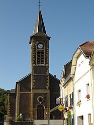
Gorcy church
|
||
|
||
| Coordinates: 49°32′08″N 5°41′07″E / 49.5356°N 5.6853°ECoordinates: 49°32′08″N 5°41′07″E / 49.5356°N 5.6853°E | ||
| Country | France | |
| Region | Grand Est | |
| Department | Meurthe-et-Moselle | |
| Arrondissement | Briey | |
| Canton | Mont-Saint-Martin | |
| Intercommunality | Communauté de communes de l'agglomération de Longwy | |
| Government | ||
| • Mayor (2008–2014) | Bernard Labbe | |
| Area1 | 4.1 km2 (1.6 sq mi) | |
| Population (2006)2 | 2,333 | |
| • Density | 570/km2 (1,500/sq mi) | |
| Time zone | CET (UTC+1) | |
| • Summer (DST) | CEST (UTC+2) | |
| INSEE/Postal code | 54234 /54730 | |
| Elevation | 235–385 m (771–1,263 ft) | |
|
1 French Land Register data, which excludes lakes, ponds, glaciers > 1 km² (0.386 sq mi or 247 acres) and river estuaries. 2Population without double counting: residents of multiple communes (e.g., students and military personnel) only counted once. |
||
1 French Land Register data, which excludes lakes, ponds, glaciers > 1 km² (0.386 sq mi or 247 acres) and river estuaries.
Gorcy is a French commune, located in the department of Meurthe-et-Moselle and the Grand Est region. This village on the north of the Meurthe-et-Moselle is next to the Belgian frontier, and about 10 km from Longwy, main city of the "Pays-Haut".
Its inhabitants are named Gorcéens and Gorcéennes.
In 1832, Jean Joseph Labbé built a first blast furnace in Gorcy, on the Parivaux. From 1846 to 1848, two new blast furnaces were built. The factory, partially destroyed during the war of 1870, is rebuilt and set in rights. In 1877, the two blast furnaces were removed and replaced by two other more powerful. Before the World War I, the Société métallurgique de Gorcy still exploits two blast furnaces which will disappear in the 30's.
...
Wikipedia


