Goose Creek, South Carolina
| Goose Creek, South Carolina | |
|---|---|
| City | |
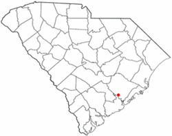
 Location of Goose Creek, South Carolina |
|
| Coordinates: 33°0′N 80°2′W / 33.000°N 80.033°WCoordinates: 33°0′N 80°2′W / 33.000°N 80.033°W | |
| Country | United States |
| State | South Carolina |
| Counties | Berkeley |
| Area | |
| • Total | 40.8 sq mi (105.8 km2) |
| • Land | 40.1 sq mi (103.8 km2) |
| • Water | 0.8 sq mi (2.0 km2) |
| Elevation | 46 ft (14 m) |
| Population (2010) | |
| • Total | 35,938 |
| • Density | 897/sq mi (346.2/km2) |
| Time zone | Eastern (EST) (UTC-5) |
| • Summer (DST) | EDT (UTC-4) |
| ZIP code | 29445 |
| Area code(s) | 843 |
| FIPS code | 45-29815 |
| GNIS feature ID | 1231332 |
| Website | www |
Goose Creek is a city in Berkeley County in the U.S. state of South Carolina. The population was 35,938 at the 2010 census. Most of the Naval Weapons Station Charleston is in Goose Creek. As defined by the U.S. Office of Management and Budget, and used only by the U.S. Census Bureau and other Federal agencies for statistical purposes, Goose Creek is included within the Charleston-North Charleston-Summerville metropolitan area and the Charleston-North Charleston Urbanized Area.
Goose Creek is located in southern Berkeley County at 33°0′N 80°2′W / 33.000°N 80.033°W (32.9955, -80.0289). It is bordered to the east by the Cooper River and the Back River, to the southeast by an outer portion of the city of Charleston, to the southwest by the city of Hanahan and (farther to the west) the city of North Charleston in Charleston County, and to the west by the unincorporated community of Ladson.
According to the United States Census Bureau, the city has a total area of 40.8 square miles (105.8 km2), of which 40.1 square miles (103.8 km2) is land and 0.77 square miles (2.0 km2), or 1.88%, is water.
...
Wikipedia
