Golog Tibetan Autonomous Prefecture
|
Guoluo Prefecture 果洛州 · མགོ་ལོག་ཁུལ། |
|
|---|---|
| Autonomous prefectures | |
|
果洛藏族自治州
མགོ་ལོག་བོད་རིགས་རང་སྐྱོང་ཁུལ་
|
|

Eastern Guoluo Tibetan Autonomous Prefecture
|
|
 Location of Golog Prefecture in Qinghai |
|
| Country | People's Republic of China |
| Province | Qinghai |
| Prefecture seat | Maqên County (Dawu) |
| Time zone | China Standard (UTC+8) |
| Website | guoluo |
Golog (or Guoluo) Tibetan Autonomous Prefecture (Chinese: 果洛藏族自治州; pinyin: Guǒluò Zàngzú Zìzhìzhōu; Tibetan: མགོ་ལོག་བོད་རིགས་རང་སྐྱོང་ཁུལ་, Wylie: Mgo-log Bod-rigs rang-skyong-khul) is an autonomous prefecture occupying the southeastern corner of Qinghai province, People's Republic of China. The prefecture has an area of 76,312 km2 (29,464 sq mi) and its seat is located in Maqên County.
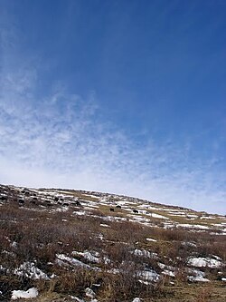
Golog Prefecture is located in the southeastern part of Qinghai, in the upper basin of the Yellow River. Gyaring Lake and Ngoring Lake on the western edge of the prefecture are considered to be the source of the Yellow River. However, these lakes do receive water from rivers that flow from locations even further west, in Qumarleb County of the Yushu Tibetan Autonomous Prefecture.
The lay of the land of the prefecture is largely determined by the Amne Machin mountain range (max elevation 6,282 m), which runs in the general northwest- to-southeast direction across the entire prefecture, and beyond. The existence of the ridge results in one of the great bends of the Yellow River, which first flows for several hundreds of kilometers toward the east and southeast along through the entire Golog Prefecture, along the southern side of the Amne Machin Range, until it reaches the borders of Gansu and Sichuan; it and then turns almost 180 degrees and flows toward the northwest for 200–300 km (120–190 mi) through several prefectures of the northeastern Qinghai, forming a section of the northeastern border of the Golog prefecture.
...
Wikipedia
