Golf de Saint Nom
| Saint-Nom-la-Bretèche | ||
|---|---|---|
| Commune | ||

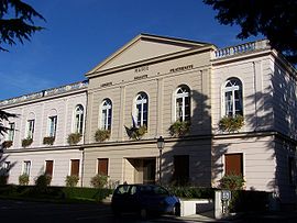
Town hall
|
||
|
||
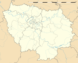
| Coordinates: 48°51′38″N 2°01′20″E / 48.8606°N 2.0222°ECoordinates: 48°51′38″N 2°01′20″E / 48.8606°N 2.0222°E | ||
| Country | France | |
| Region | Île-de-France | |
| Department | Yvelines | |
| Arrondissement | Saint-Germain-en-Laye | |
| Canton | Verneuil-sur-Seine | |
| Government | ||
| • Mayor (2008–-) | Manuelle Wajsblat | |
| Area1 | 48.27 km2 (18.64 sq mi) | |
| Population (2006)2 | 5,022 | |
| • Density | 100/km2 (270/sq mi) | |
| Time zone | CET (UTC+1) | |
| • Summer (DST) | CEST (UTC+2) | |
| INSEE/Postal code | 78571 /78860 | |
| Elevation | 112.8–187.5 m (370–615 ft) (avg. 144.5 m or 474 ft) |
|
|
1 French Land Register data, which excludes lakes, ponds, glaciers > 1 km² (0.386 sq mi or 247 acres) and river estuaries. 2Population without double counting: residents of multiple communes (e.g., students and military personnel) only counted once. |
||
1 French Land Register data, which excludes lakes, ponds, glaciers > 1 km² (0.386 sq mi or 247 acres) and river estuaries.
Saint-Nom-la-Bretèche is a wealthy commune in the Yvelines department in the Île-de-France in north-central France.
Saint-Nom-la-Bretèche was built around 4 core hamlets near the Forest of Marly. The village takes its name from a 9th-century co-bishop, saint Nonne, who re-evangelized the country after the Norman invasions, and from La Bretesche, a wooden stronghold (from breit eiche: big oak tree) consisting of a hamlet at the edge of the forest of Cruye, now the forest of Marly.
The hamlet was originally called "Saint-Nonne au Val de Galie", the name of the parish, then "Saint-Nom près de la Bretesche" and since the Revolution, "Saint-Nom-la-Bretèche".
During the French Revolution the district was called "La Montagne Fromentale" and then "l'Union la Bretesche".
The hamlets of Avinières, Val-Martin, La Tuilerie-Bignon were the responsibility of numerous lords, as well as of the Dames de Poissy and the Vaux-de-Cernay Abbey.
The north of the village, La Bretèche, was part of Marly Park, while the south, Saint-Nom, was part of Versailles Park, making it difficult for the village as a whole to acquire an identity well into the 20th century.
Steady demographic growth, which accelerated significantly after 1982, eventually unified the two villages and allowed the building of a "Centre Village" and a Library by 2000.
Some historic structures in the village suffered irreparable damage from a freak storm with tornado strength winds that struck France in December 1999. The storm, which also damaged nearby Versailles, uprooted centuries-old trees and part of the wall of the Château de la Bretèche along the Route de Sainte Gemme.
Saint Nom is known internationally for its golf course in the Tuilerie area.
...
Wikipedia


