Goiás Velho
| Goiás | |
|---|---|
| Municipality | |
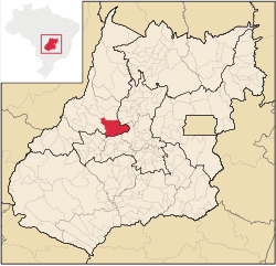
 Location in Goiás state |
|
| Location in Brazil | |
| Coordinates: 15°56′2″S 50°8′24″W / 15.93389°S 50.14000°WCoordinates: 15°56′2″S 50°8′24″W / 15.93389°S 50.14000°W | |
| Country |
|
| Region | Central-West Region |
| State | Goiás |
| Microregion | Rio Vermelho |
| Area | |
| • Total | 3,108 km2 (1,200 sq mi) |
| Elevation | 496 m (1,627 ft) |
| Population (2015) | |
| • Total | 24,439 |
| • Density | 7.9/km2 (20/sq mi) |
| Time zone | BRT/BRST (UTC-3/-2) |
| Website | http://www.prefeituradegoias.go.gov.br/ |
 |
|
| UNESCO World Heritage Site | |
|---|---|
| Official name | Historic Centre of the Town of Goiás |
| Location |
Goiás, Brazil |
| Coordinates | 15°56′02″S 50°08′24″W / 15.9339°S 50.14°W |
| Area | 3,108.018 km2 (3.345443×10¹⁰ sq ft) |
| Criteria | Cultural: ii, iv |
| Reference | 993 |
| Inscription | 2001 (25th Session) |
| Website | www |
|
[]
|
|
Goiás (also known as Goiás Velho, Old Goiás) is a municipality in the state of Goiás in Brazil. Its population was 24,439 (2015) and its area is 3,108 km². It is the former capital of the state and preserves much of its colonial heritage. In 2002, it became a UNESCO World Heritage Site.
It was the old state capital of Goiás until 1937, when the government seat was transferred to the recently built Goiânia. It was founded by the famed Bandeirante explorer Bartolomeu Bueno da Silva, nicknamed the Anhangüera, and was called in colonial times Vila Boa de Goyaz ("Good Village of Goyaz" in archaic Portuguese). Given its historical importance, the historical center of Goiás was included on UNESCO's World Heritage list in 2001.
Municipal boundaries:
Distances
Access can be made by highways GO-070 / Goianira / Inhumas / Itaberaí / BR-070.Sepin
The topography of the municipality is characterized by rugged terrain and several rivers. The Serra Dourada Mountains are nearby. The municipality contains part of the 26,626 hectares (65,790 acres) Serra Dourada State Park, created in 2003. Waterfalls and rapids are easily accessible from the center and several of them have beaches open to the public. The most important are:
Rivers that cross the municipality are:
The economy of the region is dependent on tourism, cattle raising, and agriculture. The cattle herd consisted of 241,000 head. The main agricultural products were banana, oranges, hearts of palm, rice (2,600 hectares), beans, corn (3,800 hectares), soybeans and wheat
Economic data
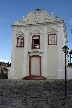
Goiás Velho was founded in 1727, its name being a tribute to the Goyaz Indians, the inhabitants of the area before the arrival of the Europeans. Its houses, chapels and churches are testimony to the height of the gold rush era. The history of the town, which is intertwined with the history of Goiás state, and certain reminders of the wealth of past centuries carved in gold, can be seen in places such as the Museu das Bandeiras, built in 1761; the Colégio Sant'Ana, founded in 1879 by Dominican friars; the church of Nossa Senhora d'Abadia, constructed in 1790, with its altar painted in blue and gold; and the Casa da Fundição, dating from 1752, where the gold from the mines was cast.
...
Wikipedia


