Glovelier
| Glovelier | ||
|---|---|---|
| Former municipality of Switzerland | ||

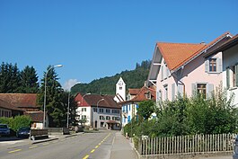
Glovelier village
|
||
|
||
| Coordinates: 47°20′N 07°12′E / 47.333°N 7.200°ECoordinates: 47°20′N 07°12′E / 47.333°N 7.200°E | ||
| Country | Switzerland | |
| Canton | Jura | |
| District | Delémont | |
| Area | ||
| • Total | 14.34 km2 (5.54 sq mi) | |
| Elevation | 515 m (1,690 ft) | |
| Population (2011) | ||
| • Total | 1,200 | |
| • Density | 84/km2 (220/sq mi) | |
| Postal code | 2855 | |
| SFOS number | 6714 | |
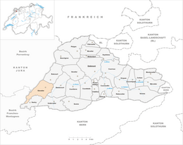
| Surrounded by | Boécourt, Bassecourt, Undervelier, Saulcy, Saint-Brais, Clos du Doubs | |
| Website |
www SFSO statistics |
|
Glovelier is a former municipality in the district of Delémont in the canton of Jura in Switzerland. On 1 January 2013 the former municipalities of Bassecourt, Courfaivre, Glovelier, Soulce and Undervelier merged to form the new municipality of Haute-Sorne.
Glovelier is first mentioned in 1139 as Lolenviler.
Glovelier had an area of 14.34 km2 (5.54 sq mi). Of this area, 5.99 km2 (2.31 sq mi) or 41.8% is used for agricultural purposes, while 6.71 km2 (2.59 sq mi) or 46.8% is forested. Of the rest of the land, 1.57 km2 (0.61 sq mi) or 10.9% is settled (buildings or roads), 0.03 km2 (7.4 acres) or 0.2% is either rivers or lakes and 0.03 km2 (7.4 acres) or 0.2% is unproductive land.
Of the built up area, industrial buildings made up 1.3% of the total area while housing and buildings made up 3.1% and transportation infrastructure made up 5.4%. Out of the forested land, 43.2% of the total land area is heavily forested and 3.6% is covered with orchards or small clusters of trees. Of the agricultural land, 11.4% is used for growing crops and 18.3% is pastures and 11.5% is used for alpine pastures. All the water in the municipality is flowing water.
The former municipality is located in the Delemont district, on the western end of the Delemont valley. The village lies at the intersection of the old road from Porrentruy to Biel and from Delemont to La Chaux-de-Fonds. It consists of the village of Glovelier and the hamlet of Sceut.
The blazon of the municipal coat of arms is Argent, between two Laurel Branches Proper in pale Fasces Gules, ribboned Or and double bladed Proper topped with a Roman Helmet Or crested Gules.
...
Wikipedia


