Clos du Doubs
| Clos du Doubs | ||
|---|---|---|

Clos du Doubs
|
||
|
||
| Coordinates: 47°21′N 07°09′E / 47.350°N 7.150°ECoordinates: 47°21′N 07°09′E / 47.350°N 7.150°E | ||
| Country | Switzerland | |
| Canton | Jura | |
| District | Porrentruy | |
| Government | ||
| • Mayor | Maire | |
| Area | ||
| • Total | 61.77 km2 (23.85 sq mi) | |
| Elevation | 440 m (1,440 ft) | |
| Population (Dec 2015) | ||
| • Total | 1,306 | |
| • Density | 21/km2 (55/sq mi) | |
| Postal code | 2882 | |
| SFOS number | 6808 | |
| Localities | Epauvillers, Epiquerez, Montenol, Montmelon, Ocourt, Saint-Ursanne and Seleute | |
| Surrounded by | Montfaucon, Soubey, Saint-Brais, La Baroche, Glovelier, Boécourt, Cornol, Courgenay, Fontenais, Bressaucourt, Montancy (F), Burnevillers (F) | |
| Website |
http://www.closdudoubs.ch SFSO statistics |
|
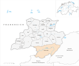
Clos du Doubs (Franc-Comtois: Chôs di Doubs) is a municipality in the district of Porrentruy in the canton of Jura in Switzerland. It was founded on January 1, 2009 by the former municipalities of Epauvillers, Epiquerez, Montenol, Montmelon, Ocourt, Saint-Ursanne and Seleute.Soubey voted not to join the merger.
The new town took its name from the Clos du Doubs region (which also includes Soubey). The region includes the section of the Doubs valley near Saint-Ursanne, about 15 km (9.3 mi) west of Delémont. The region covers about 80 km2 (31 sq mi), centered on the village of Saint-Ursanne.
Clos du Doubs can also refer to a range of the Jura folds south-west of Saint-Ursanne.
Clos du Doubs has an area of 61.77 km2 (23.85 sq mi). Of this area, 26.51 km2 (10.24 sq mi) or 42.9% is used for agricultural purposes, while 32.21 km2 (12.44 sq mi) or 52.1% is forested. Of the rest of the land, 2.24 km2 (0.86 sq mi) or 3.6% is settled (buildings or roads), 0.78 km2 (0.30 sq mi) or 1.3% is either rivers or lakes and 0.08 km2 (20 acres) or 0.1% is unproductive land.
Of the built up area, housing and buildings made up 1.2% and transportation infrastructure made up 2.0%. Out of the forested land, 48.7% of the total land area is heavily forested and 3.4% is covered with orchards or small clusters of trees. Of the agricultural land, 5.7% is used for growing crops and 27.5% is pastures and 9.5% is used for alpine pastures. All the water in the municipality is flowing water.
...
Wikipedia


