Soubey
| Soubey | ||
|---|---|---|

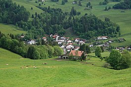
Soubey village
|
||
|
||
| Coordinates: 47°18′N 07°03′E / 47.300°N 7.050°ECoordinates: 47°18′N 07°03′E / 47.300°N 7.050°E | ||
| Country | Switzerland | |
| Canton | Jura | |
| District | Franches-Montagnes | |
| Government | ||
| • Mayor | Maire | |
| Area | ||
| • Total | 13.47 km2 (5.20 sq mi) | |
| Elevation | 476 m (1,562 ft) | |
| Population (Dec 2015) | ||
| • Total | 132 | |
| • Density | 9.8/km2 (25/sq mi) | |
| Postal code | 2887 | |
| SFOS number | 6759 | |
| Surrounded by | Les Pommerats, Les Enfers, Epiquerez, Burnevillers(F), Indevillers(F) | |
| Website |
www SFSO statistics |
|
Soubey is a municipality in the district of Franches-Montagnes in the canton of Jura in Switzerland.
Soubey is first mentioned in 1340 as Subeis. In 1369 it was mentioned as Subiez.
Because Soubey is among the few locations in Switzerland with no cell phone reception and few other sources of electromagnetic radiation, it has attracted – to the disapproval of its residents – numerous visitors seeking relief from electromagnetic hypersensitivity.
Soubey has an area of 13.47 km2 (5.20 sq mi). Of this area, 5.19 km2 (2.00 sq mi) or 38.5% is used for agricultural purposes, while 7.65 km2 (2.95 sq mi) or 56.8% is forested. Of the rest of the land, 0.3 km2 (0.12 sq mi) or 2.2% is settled (buildings or roads), 0.31 km2 (0.12 sq mi) or 2.3% is either rivers or lakes and 0.04 km2 (9.9 acres) or 0.3% is unproductive land.
Of the built up area, housing and buildings made up 1.0% and transportation infrastructure made up 1.2%. Out of the forested land, 54.0% of the total land area is heavily forested and 2.8% is covered with orchards or small clusters of trees. Of the agricultural land, 3.5% is used for growing crops and 24.7% is pastures and 10.1% is used for alpine pastures. All the water in the municipality is flowing water.
The municipality is located in the Franches-Montagnes district and straddles the Doubs river. It consists of the village of Soubey and the hamlets of Clairbief, Chercenay, Froidevaux and Le Chaufour on the left side of the river as well as the hamlets of Lobschez and Les Moulins on the right side.
The municipalities of Le Bémont, Les Bois, Les Breuleux, La Chaux-des-Breuleux, Les Enfers, Les Genevez, Lajoux, Montfaucon, Muriaux, Le Noirmont, Saignelégier, Saint-Brais and Soubey are considering a merger on at a date in the future into the new municipality of Franches-Montagnes.
...
Wikipedia


