Glenmoor, Ohio
| Glenmoor, Ohio | |
|---|---|
| Census-designated place | |
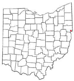
 Location of Glenmoor, Ohio |
|
| Coordinates: 40°39′55″N 80°36′47″W / 40.66528°N 80.61306°WCoordinates: 40°39′55″N 80°36′47″W / 40.66528°N 80.61306°W | |
| Country | United States |
| State | Ohio |
| County | Columbiana |
| Township | St. Clair |
| Area | |
| • Total | 2.8 sq mi (7.2 km2) |
| • Land | 2.8 sq mi (7.2 km2) |
| • Water | 0.0 sq mi (0.0 km2) |
| Elevation | 1,122 ft (342 m) |
| Population (2010) | |
| • Total | 1,987 |
| • Density | 711/sq mi (274.4/km2) |
| Time zone | Eastern (EST) (UTC-5) |
| • Summer (DST) | EDT (UTC-4) |
| FIPS code | 39-30520 |
| GNIS feature ID | 1040911 |
Glenmoor is a census-designated place (CDP) in Columbiana County, Ohio, United States. The population was 1,987 at the 2010 census.
Glenmoor is located in southeastern Columbiana County at 40°39′55″N 80°36′47″W / 40.66528°N 80.61306°W (40.665198, -80.613044), in the southwest corner of St. Clair Township. Its northeast border is formed by U.S. Route 30, across which is the CDP of Calcutta. It is bordered to the south by La Croft in Liverpool Township and to the west by Madison Township. The city of East Liverpool on the Ohio River is 4 miles (6 km) to the southeast.
According to the United States Census Bureau, the Glenmoor CDP has a total area of 2.8 square miles (7.2 km2), all land.
As of the census of 2000, there were 2,192 people, 877 households, and 637 families residing in the CDP. The population density was 783.6 people per square mile (302.3/km²). There were 913 housing units at an average density of 326.4/sq mi (125.9/km²). The racial makeup of the CDP was 97.54% White, 1.19% African American, 0.27% Native American, 0.14% Asian, 0.09% from other races, and 0.78% from two or more races. Hispanic or Latino of any race were 0.73% of the population.
...
Wikipedia
