Glacier Noir
| Glacier Noir | |
|---|---|

The Glacier Noir with the Ailefroide in the background
|
|
| Type | Valley glacier |
| Coordinates | 44°54′54″N 6°23′0″E / 44.91500°N 6.38333°ECoordinates: 44°54′54″N 6°23′0″E / 44.91500°N 6.38333°E |
| Area | 5.95 km2 (2.30 sq mi) (1965) |
| Length | 5.5 km (3.4 mi) (1965) |
| Highest elevation | 3,300 m |
| Lowest elevation | 2,200 m |
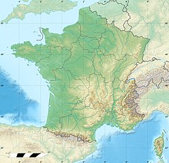
The Glacier Noir (French for "black glacier") is a glacier in the Massif des Écrins in the French Alps. It is located in the département of Hautes-Alpes.
Of all the great glaciers in the Oisans region, the Glacier Noir is the one that descends furthest into the valley. This is thanks to favourable topography and the fact that the lower tongue of the glacier is entirely covered with ablation moraine. As a result, it is better screened from direct sunshine than, for example, its neighbour, the Glacier Blanc ("white glacier").
Until at least 1866 the Glacier Noir and Glacier Blanc were combined into a single glacial system above the Pré de Madame Carle. But whilst the foot of the Glacier Blanc has retreated today to a height of around 2,400 m, the snout of the Glacier Noir descends a further 200 metres in height to about 2,200 m.
A glacier covered in moraine debris is generally referred to in French as a glacier noir.
The Glacier Noir is fed from two high-altitude firn basins. The northern branch (branche septentrionale) is in turn fed from the bowl below the Col des Avalanches, at the foot of Pic Coolidge and the Barre des Écrins, the southwesternmost four-thousander of the Alps. From here it flows below the south face of the Crête de l'Encoula (also: Crête de l'Encula), a crest that runs from the Barre to the Pointe du Serre Subeyran. The great majority of the rubble that covers the lower section of the glacier is transported from its northern branch.
The southern branch (branche méridionale) originates between the faces of the Ailefroide and Pic Coolidge, below the Col de Coste Rouge (3,192 m) and the Col de la Temple (3,322 m). The steep north faces of the Ailefroide, Pic du Coup de Sabre and Pic Sans Nom tower 1,000 to 1,500 metres above the glacier. The arête, which runs over these peaks eastwards to Mont Pelvoux, is also called the Grand Muraille du Glacier Noir. Five summits along this crest (Ailefroide Central, Pointe Fourastier, Pic Sans Nom, Pointe Puiseux and Pointe Durand) exceed the 3,900 metre mark. On its left-hand side, the southern branch of the glacier is bounded by the eastern foothills of Pic Coolidge. Hemmed in between these two faces, the firn stream flows initially northeastwards before swinging north just before the two ice streams merge. Rubble first appears on the surface of the southern glacial branch in large quantities in its lower reaches.
...
Wikipedia

