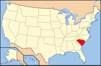
Georgetown County, South Carolina
| Georgetown County, South Carolina | ||
|---|---|---|

Georgetown County Courthouse
|
||
|
||
 Location in the U.S. state of South Carolina |
||
 South Carolina's location in the U.S. |
||
| Founded | 1769 | |
| Seat | Georgetown | |
| Largest city | Georgetown | |
| Area | ||
| • Total | 1,035 sq mi (2,681 km2) | |
| • Land | 814 sq mi (2,108 km2) | |
| • Water | 221 sq mi (572 km2), 21% | |
| Population | ||
| • (2010) | 60,158 | |
| • Density | 74/sq mi (29/km²) | |
| Congressional district | 7th | |
| Time zone | Eastern: UTC-5/-4 | |
| Website | www |
|
Georgetown County is a county located in the U.S. state of South Carolina. As of the 2010 census, the population was 60,158. Its county seat is Georgetown. The county was founded in 1769. It is named for George III of the United Kingdom.
Georgetown County comprises the Georgetown, SC Micropolitan Statistical Area, which is also included in the Myrtle Beach-Conway, SC-NC Combined Statistical Area.
According to the U.S. Census Bureau, the county has a total area of 1,035 square miles (2,680 km2), of which 814 square miles (2,110 km2) is land and 221 square miles (570 km2) (21%) is water.
Georgetown County has several rivers, including the Great Pee Dee River, the Waccamaw River, Black River, and Sampit River, all of which flow into Winyah Bay. The Santee River, which forms the southern boundary of the county, empties directly into the Atlantic. The Intracoastal Waterway crosses the county and Winyah Bay. The rivers and the bay have had a decisive effect on human development of the area, especially as the city of Georgetown has an excellent seaport and harbor.
...
Wikipedia

