Georgetown, Illinois
| Georgetown, Illinois | |
|---|---|
| City | |
 |
|
 Vermilion County's location in Illinois |
|
| Georgetown's location in Vermilion County | |
| Coordinates: 39°58′43″N 87°38′10″W / 39.97861°N 87.63611°WCoordinates: 39°58′43″N 87°38′10″W / 39.97861°N 87.63611°W | |
| Country | United States |
| State | Illinois |
| County | Vermilion County |
| Township | Georgetown Township |
| Founded | 1826 |
| Area | |
| • Total | 1.61 sq mi (4.2 km2) |
| • Land | 1.61 sq mi (4.2 km2) |
| • Water | 0.00 sq mi (0.0 km2) 0% |
| Elevation | 669 ft (204 m) |
| Population (2010) | |
| • Total | 3,474 |
| • Density | 2,200/sq mi (830/km2) |
| Time zone | CST (UTC-6) |
| • Summer (DST) | CDT (UTC-5) |
| ZIP code | 61846 |
| Area code(s) | 217 |
| Website | GeorgetownIL.com |
Georgetown is a city in Vermilion County, Illinois, United States. As of the 2010 census, the city population was 3,474. It is part of the Danville, Illinois Metropolitan Statistical Area.
Georgetown was established in 1826 and was platted by James Haworth, although the first home was established in 1820 by Henry Johnson. The town may have been named after George Beckwith, since Danville had been named after Dan Beckwith; another possibility is that it was named after James Haworth's son George. The first post office was established in 1828.
The Paris and Danville Railroad was built in 1871, and the "Interurban" started carrying passengers between Georgetown and Danville sometime after 1900.
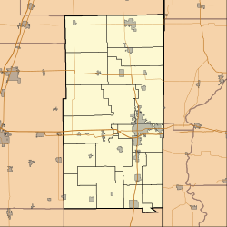
Georgetown is located on Illinois Route 1 / U.S. Route 150 about 13 miles (21 km) south of the county seat of Danville. According to the 2010 census, Georgetown has a total area of 0.14 square miles (0.36 km2), all land.
As of the census of 2000, there were 3,628 people, 1,470 households, and 1,004 families residing in the city. The population density was 2,250.6 people per square mile (870.0/km²). There were 1,564 housing units at an average density of 970.2 per square mile (375.1/km²). The racial makeup of the city was 95.53% White, 2.73% African American, 0.28% Native American, 0.06% Asian, 0.25% from other races, and 1.16% from two or more races. Hispanic or Latino of any race were 1.19% of the population.
...
Wikipedia

