Gennep
| Gennep | |||
|---|---|---|---|
| Municipality | |||

View over Gennep
|
|||
|
|||
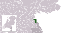
 Location in Limburg |
|||
| Coordinates: 51°42′N 5°58′E / 51.700°N 5.967°ECoordinates: 51°42′N 5°58′E / 51.700°N 5.967°E | |||
| Country | Netherlands | ||
| Province | Limburg | ||
| Government | |||
| • Body | Municipal council | ||
| • Mayor | Peter de Koning (VVD) | ||
| Area | |||
| • Total | 50.42 km2 (19.47 sq mi) | ||
| • Land | 47.71 km2 (18.42 sq mi) | ||
| • Water | 2.71 km2 (1.05 sq mi) | ||
| Elevation | 13 m (43 ft) | ||
| Population (May 2014) | |||
| • Total | 17,277 | ||
| • Density | 362/km2 (940/sq mi) | ||
| Demonym(s) | Gennepenaar, Genneper | ||
| Time zone | CET (UTC+1) | ||
| • Summer (DST) | CEST (UTC+2) | ||
| Postcode | 6590–6599 | ||
| Area code | 0485 | ||
| Website | www |
||
Gennep (![]() pronunciation ) is a municipality and a city in upper southeastern Netherlands. It lies in the northern part of the province of Limburg. Furthermore, it lies on the right bank of the Meuse river, and south of the forest of the Klever Reichswald. The municipality of Gennep has 17,277 inhabitants (2014).
pronunciation ) is a municipality and a city in upper southeastern Netherlands. It lies in the northern part of the province of Limburg. Furthermore, it lies on the right bank of the Meuse river, and south of the forest of the Klever Reichswald. The municipality of Gennep has 17,277 inhabitants (2014).
The Niers river flows into the Meuse in Gennep.
Aaldonk, Dam, De Looi, Diekendaal, Gennep, Heijen, Hekkens, Milsbeek, Ottersum, Smele, Ven-Zelderheide, and Zelder.
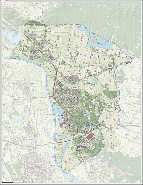
Dutch topographic map of the municipality of Gennep, June 2015
Gennep was the title of a comital family, known descendants of which are the famous Saint Norbert of Gennep and William of Gennep, Archbishop-Elector of Cologne.
...
Wikipedia


