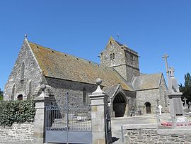
Genêts
| Genêts | |
|---|---|
 |
|
| Coordinates: 48°41′06″N 1°28′26″W / 48.685°N 1.474°WCoordinates: 48°41′06″N 1°28′26″W / 48.685°N 1.474°W | |
| Country | France |
| Region | Normandy |
| Department | Manche |
| Arrondissement | Avranches |
| Canton | Sartilly |
| Government | |
| • Mayor | Jacques Hec |
| Area1 | 6.89 km2 (2.66 sq mi) |
| Population (1999)2 | 439 |
| • Density | 64/km2 (170/sq mi) |
| Time zone | CET (UTC+1) |
| • Summer (DST) | CEST (UTC+2) |
| INSEE/Postal code | 50199 /50530 |
| Elevation | 6–38 m (20–125 ft) (avg. 10 m or 33 ft) |
|
1 French Land Register data, which excludes lakes, ponds, glaciers > 1 km² (0.386 sq mi or 247 acres) and river estuaries. 2Population without double counting: residents of multiple communes (e.g., students and military personnel) only counted once. |
|
1 French Land Register data, which excludes lakes, ponds, glaciers > 1 km² (0.386 sq mi or 247 acres) and river estuaries.
Genêts is a commune in the Manche department in northwestern France. It was the port of the oppidum Ingena (now Avranches), the main settlement of the Abrincatui.
The Manoir de Brion, an ancient Benedictine priory of the abbey of Mont Saint-Michel is located nearby. The tidal island of Tombelaine, 3.5 km (2.2 mi) offshore, is in the commune.
...
Wikipedia


