Geladaindong Peak
| Geladaindong | |
|---|---|

The glaciers of the Tanggula Mountains, the source of the Yangtze River
|
|
| Highest point | |
| Elevation | 6,621 m (21,722 ft) |
| Prominence | 1,541 m (5,056 ft) |
| Listing | Ultra |
| Coordinates | 33°29′45″N 91°10′03″E / 33.49583°N 91.16750°ECoordinates: 33°29′45″N 91°10′03″E / 33.49583°N 91.16750°E |
| Geography | |
| Location | Qinghai, China |
| Parent range | Tanggula |
| Climbing | |
| First ascent | 1985 by a Japanese team |
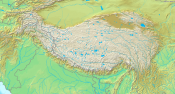
Geladaindong Peak (also spelled Geladandong, Geladaintong or Kolha Dardong) is a snow-covered mountain (or massif) located in southwestern Qinghai province of China near the border of Tibet. It is the tallest mountain in the Tanggula Mountain Range of the Tibetan Plateau with an elevation of 6,621 metres (21,722 ft) above sea level. The source of the Yangtze River, begins with glaciers on its surface.
The mountain's name is Geladaindong in the Tibetan language. The name in Chinese is (pinyin: Gèlādāndōng) or (pinyin: Gèlādāndōng Fēng; literally "Geladandong Peak").
Geladaindong is located in the administrative unit known as Tanggula Town: an exclave of Haixi Prefecture, in the middle section of Tanggula Shan (the Tanggula Mountain Range).
The Geladaindong Peak is encircled by over twenty high peaks exceeding 6,000 meters (19,685 ft) in height. It is approximately 50 km (31 mi) long from north to south and approximately 20 km (12 mi) wide from west to east, covering an area of approximately 670 square kilometres (260 sq mi) with ice and snow, covered by over 40 glaciers. This area is directly across the border from Amdo County, Nagqu Prefecture, Tibet Autonomous Region.
The Qinghai-Tibet Railway crosses the Tanggula Mountain Range around 100 km (62 mi) to the east of Geladaindong Peak.
...
Wikipedia

