Garfield, Texas
| Garfield, Texas | |
|---|---|
| CDP | |

Library and water tower
|
|
 |
|
| Coordinates: 30°11′46″N 97°33′5″W / 30.19611°N 97.55139°WCoordinates: 30°11′46″N 97°33′5″W / 30.19611°N 97.55139°W | |
| Country | United States |
| State | Texas |
| County | Travis |
| Area | |
| • Total | 12.2 sq mi (31.6 km2) |
| • Land | 12.0 sq mi (31.1 km2) |
| • Water | 0.2 sq mi (0.5 km2) |
| Elevation | 479 ft (146 m) |
| Population (2010) | |
| • Total | 1,698 |
| • Density | 140/sq mi (54/km2) |
| Time zone | Central (CST) (UTC-6) |
| • Summer (DST) | CDT (UTC-5) |
| ZIP code | 78617 |
| Area code(s) | 512 & 737 |
| FIPS code | 48-28320 |
| GNIS feature ID | 1336402 |
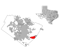
Garfield is a census-designated place (CDP) in Travis County, Texas, in the United States. As of the 2010 census, the CDP population was 1,698.
Garfield is located at 30°11′46″N 97°33′5″W / 30.19611°N 97.55139°W (30.196097, -97.551480), 12 miles (19 km) southeast of downtown Austin.
According to the United States Census Bureau in 2000, the CDP has a total area of 13.9 square miles (35.9 km²), of which, 13.7 square miles (35.4 km²) of it is land and 0.2 square miles (0.5 km²) of it (1.44%) is water. Prior to the 2010 census, part of the CDP was annexed to the city of Austin, reducing it's area to 12.2 square miles (32 km2), of which, 12.0 square miles (31 km2) of it is land and 0.2 square miles (0.52 km2) is water.
Garfield is served by the Del Valle Independent School District. The Del Valle and Hornsby-Dunlap elementary schools serve portions of the community. For middle school students are divided between Dailey Middle School and Del Valle Middle School. High school students are zoned to Del Valle High School.
The East Travis Gateway Library District operates the Garfield Library.
As of the census of 2000, there were 1,660 people, 550 households, and 421 families residing in the CDP. The population density was 121.3 people per square mile (46.9/km²). There were 585 housing units at an average density of 42.7/sq mi (16.5/km²). The racial makeup of the CDP was 73.73% White, 2.35% African American, 0.54% Native American, 1.08% Asian, 19.46% from other races, and 2.83% from two or more races. Hispanic or Latino of any race were 32.17% of the population.
...
Wikipedia
