Gangteng Monastery
| Gangteng Monastery Gangteng Gönpa Gangteng Sangngak Chöling |
|
|---|---|

Entrance Gate to Gangteng Monastery after restoration
|
|
|
|
|
| Coordinates | 27°30′N 90°10′E / 27.500°N 90.167°E |
| Monastery information | |
| Location | Wangdue Phodrang District, Bhutan |
| Founded by | Gyalsé Pema Thinley |
| Founded | In 1613 by Gyalsé Rinpoche Gangteng Tulku Rigdzin Pema Tinley (1564–1642) |
| Date renovated | October 2008 |
| Type | Tibetan Buddhist |
| Lineage | Nyingma |
| Head Lama | Rigdzin Kunzang Pema Namgyal |
| Architecture | Bhutanese Architecture |
| Festivals | Tshechu and Crane Festivals |
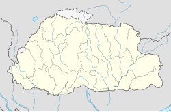
The Gangteng Monastery (Dzongkha: སྒང་སྟེང་དགོན་པ ),generally known as Gangtey Gonpa or Gangtey Monastery, is an important monastery of Nyingmapa school of Buddhism, the main seat of the Pema Lingpa tradition. located in the Wangdue Phodrang District in central Bhutan. The Monastery, also known by the Gangten village that surrounds it, is in the Phobjikha Valley where winter visitors – the black-necked cranes – visit central Bhutan to roost, circling the monastery three times on arrival and repeating this circling when returning to Tibet. The Monastery's history traces to the early 17th century and back to the prophecies made by the well-known Terton (treasure finder) Pema Lingpa in the late 15th century.
The Monastery is one of the main seats of the religious tradition based on Pema Lingpa's revelations and one of the two main centres of the Nyingmapa school of Buddhism in the country.
A Nyingma monastic college or shedra, Do-ngag Tösam Rabgayling, has been established above the village.
The descent of the first king of Bhutan, Ugyen Wangchuck of the Wangchuk Dynasty of Bhutan, which continues to rule Bhutan is traced to the clan of the Dungkhar Choje, a subsidiary of the clan of Khouchung Choje whose founder was Kunga Wangpo, the fourth son of Pema Lingpa.
The Gangteng Monastery, also spelt Gantey Gonpa, bounded on the west side by the Black Mountains (Bhutan) (range above 5,000 metres (16,000 ft) elevation) is located on a spur amidst the Gantey village, overlooking the vast U-shaped glacial Phobjika Valley, which is at an elevation of about 3,000 metres (9,800 ft) and which has marshy land. The Nake Chuu river runs through this valley. The monastery commands striking views of the Phubjika Valley below. The Black Mountain Region is inhabited by nomadic shepherds and yak-herders.
...
Wikipedia

