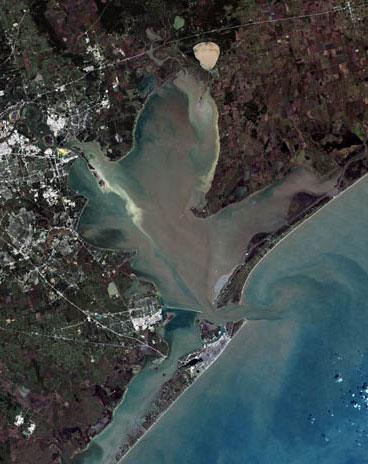
Galveston Bay
| Galveston Bay | |
|---|---|

Galveston Bay (Orbital photo courtesy of NASA)
|
|
| Location | Texas Gulf Coast |
| Coordinates | 29°34′11″N 94°56′12″W / 29.56972°N 94.93667°WCoordinates: 29°34′11″N 94°56′12″W / 29.56972°N 94.93667°W |
| River sources | San Jacinto River, Trinity River |
| Ocean/sea sources | Gulf of Mexico |
| Basin countries | United States |
| Surface area | 600 square miles (1,600 km2) |
| Settlements | Greater Houston |
Galveston Bay (/ˈɡælvᵻstən/ GAL-viss-tən) is the 7th largest estuary in the United States, located along the upper coast of Texas. It is connected to the Gulf of Mexico and is surrounded by sub-tropic marshes and prairies on the mainland. The water in the Bay is a complex mixture of sea water and fresh water which supports a wide variety of marine life.
The bay has been historically important during Texas' history. The island of Galveston was home to eastern and coastal Texas' earliest major settlement and, during the later 19th century, it was Texas' largest city. The island's port, on the bay side, became one of the top ports in the U.S. During the 20th century as the oil boom in Texas took hold the bay became even more important as a shipping center as Houston and Texas City developed into major port and industrial centers.
Today the bay is within the Houston–Sugar Land–Baytown metropolitan area, which is the fifth-largest metropolitan area in the U.S. and is home to major ports including the second-busiest port in the nation. It produces more seafood than any bay in the nation except the Chesapeake.
...
Wikipedia
