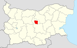
Gabrovo Municipality
|
Gabrovo Municipality Община Габрово |
|
|---|---|
| Municipality | |
 Gabrovo Municipality within Bulgaria and Gabrovo Province. |
|
| Coordinates: 42°53′N 25°17′E / 42.883°N 25.283°ECoordinates: 42°53′N 25°17′E / 42.883°N 25.283°E | |
| Country |
|
| Province (Oblast) | Gabrovo |
| Admin. centre (Obshtinski tsentar) | Gabrovo |
| Area | |
| • Total | 555.57 km2 (214.51 sq mi) |
| Population (December 2009) | |
| • Total | 67,501 |
| Time zone | EET (UTC+2) |
| • Summer (DST) | EEST (UTC+3) |
Gabrovo Municipality (Bulgarian: Община Габрово) is a municipality (obshtina) in Gabrovo Province, North-central Bulgaria, located on the northern slopes of the central Stara planina mountain to the area of the so-called Fore-Balkan. It is named after its administrative centre - the city of Gabrovo which is also the capital of the province.
The municipality embraces a territory of 555.57 km² with a population of 67,501 inhabitants, as of December 2009.
Aside from the rich cultural landmarks of the main city, the area is best known with the beautifully preserved architectural reserve of Bozhentsi village and the north approach to Shipka Pass which was a noted place of the Bulgarian history and one of the main transport connections between the north and south parts of Bulgaria and the Balkan peninsula.
(towns are shown in bold):
The following table shows the change of the population during the last four decades.
...
Wikipedia
